Golden Valley, Arizona
| Golden Valley, Arizona | |
|---|---|
| CDP | |
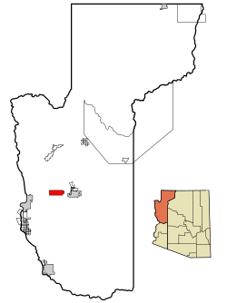
 Location in Mohave County and the state of Arizona |
|
| Location in the United States | |
| Coordinates: 35°13′23″N 114°12′54″W / 35.22306°N 114.21500°WCoordinates: 35°13′23″N 114°12′54″W / 35.22306°N 114.21500°W | |
| Country | United States |
| State | Arizona |
| County | Mohave |
| Area | |
| • Total | 28 sq mi (72.5 km2) |
| • Land | 28.0 sq mi (72.6 km2) |
| • Water | 0.0 sq mi (0.0 km2) |
| Elevation | 2,805 ft (855 m) |
| Population (2010) | |
| • Total | 8,370 |
| • Density | 161.0/sq mi (62.2/km2) |
| Time zone | MST (UTC-7) |
| ZIP code | 86413 |
| Area code(s) | 928 |
| FIPS code | 04-28195 |
| GNIS feature ID | 1866985 |
Golden Valley is an unincorporated community and a census-designated place (CDP) in Mohave County, Arizona, United States. The population was 4,515 at the 2000 census.
Golden Valley, Arizona was named after a company from Hollywood, California, that went into partnership with Crystal Collins to develop most of the land south of Highway 68 into 2.5 acre parcels. The company’s name was Golden Valley Development Company and they along with Crystal Collins sold the 2.5 acre partials for $600 each - $100 down and $10 per month.
The community of Golden Valley lies in the Sacramento Valley, separated from the larger neighboring cities of Kingman and Bullhead City by the surrounding mountain ranges. Arizona State Route 68 runs through the heart of Golden Valley, connecting it to Kingman and Bullhead City, which lie on each end of the route. Arizona 68 also functions as Golden Valley's "main street." At the eastern end of Golden Valley, Arizona 68 terminates at U.S. Route 93, which leads to Kingman to the south, or Las Vegas to the north.
Because of its close proximity to Kingman, and its residents' reliance on Kingman's grocery and retail stores for everyday necessities, Golden Valley can be considered part of the Kingman community. However, residents of Golden Valley also rely on employment in Bullhead City and Laughlin, linking Golden Valley to those communities as well.
Golden Valley is located at 35°13′23″N 114°12′54″W / 35.22306°N 114.21500°W (35.223016, -114.214988).
...
Wikipedia

