Gogebic County, Michigan
| Gogebic County, Michigan | ||
|---|---|---|

Gogebic County Courthouse, July 2014
|
||
|
||
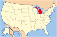
 Location in the U.S. state of Michigan |
||
 Michigan's location in the U.S. |
||
| Founded | 1887 | |
| Seat | Bessemer | |
| Largest city | Ironwood | |
| Area | ||
| • Total | 1,476 sq mi (3,823 km2) | |
| • Land | 1,102 sq mi (2,854 km2) | |
| • Water | 374 sq mi (969 km2), 25% | |
| Population | ||
| • (2010) | 16,427 | |
| • Density | 15/sq mi (6/km²) | |
| Congressional district | 1st | |
| Time zone | Central: UTC-6/-5 | |
| Website | www |
|
Gogebic County (/ɡoʊˈɡɪ.bɪk/ go-GI-bik) is the westernmost county in the Upper Peninsula in the U.S. state of Michigan. As of the 2010 census, the population was 16,427. The county seat is Bessemer. This was historically part of the territory of the Lake Superior Band of Chippewa, which had twelve bands in Michigan, Wisconsin and Minnesota. The Lac Vieux Desert Indian Reservation is in this county, in Watersmeet Township, as the land base of one of the federally recognized tribes.
The county was set off and organized in 1887. It had been part of Ontonagon County. The name is said to be derived from the Ojibwe word bic, which most references interpret as "rock." Alternatively, it is claimed to be derived from Lake Agogebic, later changed to Lake Gogebic, which was also derived from an Ojibwe word.See List of Michigan county name etymologies.
...
Wikipedia

