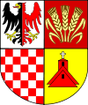
Gmina Udanin
|
Gmina Udanin Udanin Commune |
||
|---|---|---|
| Gmina | ||
|
||
| Coordinates (Udanin): 51°2′N 16°27′E / 51.033°N 16.450°ECoordinates: 51°2′N 16°27′E / 51.033°N 16.450°E | ||
| Country |
|
|
| Voivodeship | Lower Silesian | |
| County | Środa Śląska | |
| Seat | Udanin | |
| Sołectwos | Damianowo, Drogomiłowice, Dziwigórz, Gościsław, Jarosław, Jarostów, Karnice, Konary, Łagiewniki Średzkie, Lasek, Lusina, Pichorowice, Piekary, Pielaszkowice, Różana, Sokolniki, Udanin, Ujazd Dolny, Ujazd Górny | |
| Area | ||
| • Total | 110.71 km2 (42.75 sq mi) | |
| Population (2006) | ||
| • Total | 5,650 | |
| • Density | 51/km2 (130/sq mi) | |
| Website | http://www.udanin.pl | |
Gmina Udanin is a rural gmina (administrative district) in Środa Śląska County, Lower Silesian Voivodeship, in south-western Poland. Its seat is the village of Udanin, which lies approximately 16 kilometres (10 mi) south-west of Środa Śląska, and 43 kilometres (27 mi) west of the regional capital Wrocław.
The gmina covers an area of 110.71 square kilometres (42.7 sq mi), and as of 2006 its total population is 5,650.
Gmina Udanin is bordered by the gminas of Kostomłoty, Mściwojów, Środa Śląska, Strzegom, Wądroże Wielkie and Żarów.
The gmina contains the villages of Damianowo, Dębki, Dębnica, Drogomiłowice, Dziwigórz, Gościsław, Jańczów, Jarosław, Jarostów, Karnice, Konary, Księżyce, Łagiewniki Średzkie, Lasek, Lusina, Pichorowice, Piekary, Pielaszkowice, Różana, Sokolniki, Udanin, Ujazd Dolny and Ujazd Górny.
...
Wikipedia

