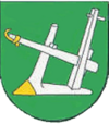
Gmina Radłów, Opole Voivodeship
|
Gmina Radłów Gemeinde Radlau Radłów Commune |
||
|---|---|---|
| Gmina | ||
|
||
| Coordinates (Radłów): 50°56′N 18°32′E / 50.933°N 18.533°E | ||
| Country |
|
|
| Voivodeship | Opole | |
| County | Olesno | |
| Seat | Radłów | |
| Area | ||
| • Total | 86.02 km2 (33.21 sq mi) | |
| Population (2006) | ||
| • Total | 4,575 | |
| • Density | 53/km2 (140/sq mi) | |
| Website | http://www.radlow.pl | |
Gmina Radłów, German Gemeinde Radlau is a rural gmina (administrative district) in Olesno County, Opole Voivodeship, in south-western Poland. Its seat is the village of Radłów, which lies approximately 11 kilometres (7 mi) north-east of Olesno and 52 km (32 mi) north-east of the regional capital Opole.
The gmina covers an area of 86.02 square kilometres (33.2 sq mi), and as of 2006 its total population is 4,575.
In 2008 the district was the first in Poland to put up bilingual Polish German signs for town names. These signs would celebrate the multicultural past of the region, which was prior to 1945 part of Germany and as of 2008 28 percent of the inhabitants were German origin.
The commune contains the villages and settlements of:
Gmina Radłów is bordered by the gminas of Gorzów Śląski, Krzepice, Olesno, Praszka and Rudniki.
Coordinates: 50°56′N 18°32′E / 50.933°N 18.533°E
...
Wikipedia

