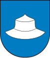
Gmina Kłobuck
|
Gmina Kłobuck Kłobuck Commune |
||
|---|---|---|
| Gmina | ||
|
||
| Coordinates (Kłobuck): 50°55′N 18°56′E / 50.917°N 18.933°ECoordinates: 50°55′N 18°56′E / 50.917°N 18.933°E | ||
| Country |
|
|
| Voivodeship | Silesian | |
| County | Kłobuck | |
| Seat | Kłobuck | |
| Area | ||
| • Total | 130.4 km2 (50.3 sq mi) | |
| Population (2006) | ||
| • Total | 20,371 | |
| • Density | 160/km2 (400/sq mi) | |
| • Urban | 13,193 | |
| • Rural | 7,178 | |
Gmina Kłobuck is an urban-rural gmina (administrative district) in Kłobuck County, Silesian Voivodeship, in southern Poland. Its seat is the town of Kłobuck, which lies approximately 75 kilometres (47 mi) north of the regional capital Katowice.
The gmina covers an area of 130.4 square kilometres (50.3 sq mi), and as of 2006 its total population is 20,371 (out of which the population of Kłobuck amounts to 13,193, and the population of the rural part of the gmina is 7,178).
Apart from the town of Kłobuck, Gmina Kłobuck contains the villages and settlements of Biała Dolna, Biała Górna, Borowianka, Gruszewnia, Kamyk, Kopiec, Lgota, Libidza, Łobodno, Nowa Wieś and Rybno.
Gmina Kłobuck is bordered by the city of and by the gminas of Miedźno, Mykanów, Opatów and Wręczyca Wielka.
...
Wikipedia

