Glouster, Ohio
| Glouster, Ohio | |
|---|---|
| Village | |

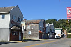
High Street downtown
|
|
| Nickname(s): "G-town" | |
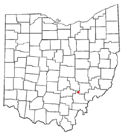
 Location of Glouster, Ohio |
|
 Location of Glouster in Athens County |
|
| Coordinates: 39°30′9″N 82°4′56″W / 39.50250°N 82.08222°WCoordinates: 39°30′9″N 82°4′56″W / 39.50250°N 82.08222°W | |
| Country | United States |
| State | Ohio |
| County | Athens |
| Township | Trimble |
| Area | |
| • Total | 1.34 sq mi (3.47 km2) |
| • Land | 1.33 sq mi (3.44 km2) |
| • Water | 0.01 sq mi (0.03 km2) |
| Elevation | 679 ft (207 m) |
| Population (2010) | |
| • Total | 1,791 |
| • Estimate (2012) | 1,772 |
| • Density | 1,346.6/sq mi (519.9/km2) |
| Time zone | Eastern (EST) (UTC-5) |
| • Summer (DST) | EDT (UTC-4) |
| ZIP code | 45732 |
| Area code(s) | 740 |
| FIPS code | 39-30674 |
| GNIS feature ID | 1075930 |
Glouster is a village in Trimble Township, Athens County, Ohio, United States. The population was 1,791 at the 2010 census. It is close to Burr Oak State Park.
Formerly called Sedalia, the present name of Glouster, after Gloucester, England, was adopted in 1886. A post office called Glouster has been in operation since 1887.
A Buckingham Coal Company deep mine is located north of town. The nearby mining pit was recently closed, with active operations moved to the east of Burr Oak State Park, but the loading station is still at the old site because of the location of the railroad. The Trimble high school and middle school provide some local employment, as does Frog Ranch Salsa, and Hocking-Athens-Perry Community Action Programs (HAPCAP). Some local residents commute to work in industry in Logan, or jobs in Athens. Tourist activity from nearby Burr Oak State Park as well as hunting in various nearby public lands also supports the economy. The village owns its own electrical and water utility, although it purchases the electricity from American Electric Power and the water from the Sunday Creek Water District.
Glouster is located at 39°30′9″N 82°4′56″W / 39.50250°N 82.08222°W (39.502586, -82.082203), along Sunday Creek. The village is located entirely within the Sunday Creek watershed, mostly on riparian plains or old stream terraces.
...
Wikipedia
