Gloucester County, VA
| Gloucester County, Virginia | ||
|---|---|---|

Gloucester County Courthouse Square, historic district
|
||
|
||
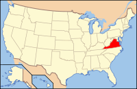
 Location in the U.S. state of Virginia |
||
 Virginia's location in the U.S. |
||
| Founded | 1651 | |
| Named for | Henry Stuart, Duke of Gloucester | |
| Seat | Gloucester Courthouse | |
| Largest community | Gloucester Point | |
| Area | ||
| • Total | 288 sq mi (746 km2) | |
| • Land | 218 sq mi (565 km2) | |
| • Water | 70 sq mi (181 km2), 24.4% | |
| Population (est.) | ||
| • (2015) | 37,143 | |
| • Density | 129/sq mi (50/km²) | |
| Congressional district | 1st | |
| Time zone | Eastern: UTC-5/-4 | |
| Website | gloucesterva |
|
Gloucester County (/ˈɡlɒstər/) is a county in the Commonwealth of Virginia. As of the 2010 census, the population was 36,858. Its county seat is Gloucester Courthouse. The county was founded in 1651 in the Virginia Colony and is named for Henry Stuart, Duke of Gloucester (third son of King Charles I of England).
Gloucester County is included in the Virginia Beach-Norfolk-Newport News, VA-NC Metropolitan Statistical Area. Located at the east end of the lower part of the Middle Peninsula, it is bordered on the south by the York River and the lower Chesapeake Bay on the east. The waterways shaped its development. Gloucester County is about 75 miles (121 km) east of Virginia's capital, Richmond.
Werowocomoco, capital of the large and powerful Powhatan Confederacy (a union of 30 Indian tribes under a paramount chief), was located on this part of the peninsula. In 2003 archeologists established that dense village had been located at this site from AD 1200 to the early 17th century.
...
Wikipedia

