Glen Innes Severn Council
|
Glen Innes Severn New South Wales |
|||||||||||||
|---|---|---|---|---|---|---|---|---|---|---|---|---|---|

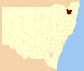
Location in New South Wales
|
|||||||||||||
| Coordinates | 29°43′S 151°45′E / 29.717°S 151.750°ECoordinates: 29°43′S 151°45′E / 29.717°S 151.750°E | ||||||||||||
| Population | 8,999 (2015 est) | ||||||||||||
| • Density | 1.64006/km2 (4.2477/sq mi) | ||||||||||||
| Area | 5,487 km2 (2,118.5 sq mi) | ||||||||||||
| Mayor | Colin Price (Unaligned) | ||||||||||||
| Council seat | Glen Innes | ||||||||||||
| Region | New England | ||||||||||||
| State electorate(s) | Northern Tablelands | ||||||||||||
| Federal Division(s) | New England | ||||||||||||
 |
|||||||||||||
| Website | Glen Innes Severn | ||||||||||||
|
|||||||||||||
Glen Innes Severn is a local government area in the New England region of New South Wales, Australia. The council serves an area of 5,487 square kilometres (2,119 sq mi) and is located adjacent to the New England Highway. The council was formed by the amalgamation of Severn Shire and Glen Innes City Council.
The Mayor of Glen Innes Severn Council is Cr. Colin Price, who is unaligned in any political party.
The council area includes the town of Glen Innes and villages including Emmaville, Deepwater, Wellingrove, Glencoe, Stonehenge and Red Range.
At the 2011 census, there were 8,656 people in the Glen Innes Severn local government area, of these 49.5 per cent were male and 50.5 per cent were female. Aboriginal and Torres Strait Islander people made up 5.6 per cent of the population which is approximately double both the national and state averages. The median age of people in the Glen Innes Severn Council area was 46 years; nearly ten years higher than the national median. Children aged 0 – 14 years made up 18.1 per cent of the population and people aged 65 years and over made up 22.0 per cent of the population. Of people in the area aged 15 years and over, 48.7 per cent were married and 14.1 per cent were either divorced or separated.
...
Wikipedia
