Glastonbury, CT
| Glastonbury, Connecticut | ||
|---|---|---|
| Town | ||
|
||
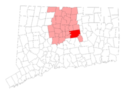
 Location of Glastonbury in Hartford County, Connecticut |
||
| Coordinates: 41°41′13″N 72°32′41″W / 41.68694°N 72.54472°WCoordinates: 41°41′13″N 72°32′41″W / 41.68694°N 72.54472°W | ||
| Country | United States | |
| State | Connecticut | |
| NECTA | Hartford | |
| County | Hartford | |
| Region | Capitol Region | |
| Settled | 1636 | |
| Incorporated | 1693 | |
| Government | ||
| • Type | Council-manager | |
| • Town manager | Richard J. Johnson | |
| • Town council | Susan Karp, Chm. Whit Osgood, Vice Chm. Carol Hemlock Ahlschlager Stewart Beckett, III Kurt P. Cavanaugh Marti Curtiss Timothy P. Coon Bob Zalungo Michele Jacklin |
|
| Area | ||
| • Total | 52.2 sq mi (135.2 km2) | |
| • Land | 51.3 sq mi (132.8 km2) | |
| • Water | 0.9 sq mi (2.4 km2) | |
| Elevation | 417 ft (127 m) | |
| Population (2010) | ||
| • Total | 34,427 | |
| • Density | 660/sq mi (250/km2) | |
| Time zone | Eastern (UTC-5) | |
| • Summer (DST) | Eastern (UTC-4) | |
| ZIP code | 06025, 06033, 06073 | |
| Area code(s) | 860 | |
| FIPS code | 09-31240 | |
| GNIS feature ID | 0213432 | |
| Website | www |
|
Glastonbury is a town in Hartford County, Connecticut, United States, formally founded in 1693 with settlers first arriving in 1636. The town was named after Glastonbury in Somerset, England. Glastonbury is located on the banks of the Connecticut River, 7 miles (11 km) southeast of Hartford. The town center is defined by the U.S. Census Bureau as a census-designated place (CDP). The population was 34,427 at the 2010 census.
In 2013, the South Glastonbury zip code, 06073, was ranked the 11th wealthiest zip code in Connecticut. The town also has the Crystal Ridge neighborhood, which is estimated to be the wealthiest neighborhood in the Greater Hartford area.
According to the United States Census Bureau, the town has a total area of 52.2 square miles (135.2 km2), of which 51.3 square miles (132.8 km2) is land and 0.93 square miles (2.4 km2), or 1.76%, is water. The Glastonbury Center CDP has a total area of 4.9 square miles (12.7 km2), of which 3.30% is water.
The town begins on the banks of the Connecticut River and extends up into foothills, many of which provide a view of Hartford's skyline. Some major developments in the town are built entirely on relatively steep hills, such as "Minnechaug Mountain", the major residential area developed from the 1970s until late '90s.
Part of Glastonbury resides in an area called "Kongscut Mountain", locally called "Rattlesnake Mountain", because it has a small population of timber rattlesnakes. Since that area is sparsely developed and mostly in a state forest, the snakes don't pose much of a threat.
The town boasts a small private lake named Diamond Lake, which is surrounded by growing subdivisions of large homes. Access to the lake is limited to members of the Diamond Lake Property Owners Association.
...
Wikipedia

