Giridih
|
Giridih गिरिडीह |
||||||||
|---|---|---|---|---|---|---|---|---|
| Town | ||||||||
from the top:
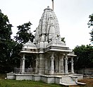
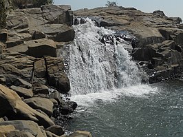
Shikharji Parasnath, Kabir gyan mandir Arati Rakshitbari, Chandranan Temple Sumitnath Temple, Usri Falls |
||||||||
| Location in Jharkhand, India | ||||||||
| Coordinates: 24°11′N 86°18′E / 24.18°N 86.3°ECoordinates: 24°11′N 86°18′E / 24.18°N 86.3°E | ||||||||
| Country |
|
|||||||
| State | Jharkhand | |||||||
| District | Giridih district | |||||||
| Named for | Surrounded by mountains(Giri) | |||||||
| Area | ||||||||
| • Total | 87.4 km2 (33.7 sq mi) | |||||||
| Elevation | 289 m (948 ft) | |||||||
| Population (2015) | ||||||||
| • Total | 173,529 | |||||||
| • Density | 2,000/km2 (5,100/sq mi) | |||||||
| Languages | ||||||||
| • Official | Hindi, Santhali | |||||||
| Time zone | IST (UTC+5:30) | |||||||
| PIN | 815301 | |||||||
| Telephone code | 0-6532 | |||||||
| Vehicle registration | JH | |||||||
| Website | www |
|||||||
Giridih (Hindi: गिरिडीह) is headquarters of the Giridih district of Jharkhand state, India. The literal meaning of Giridih is the land of hills and hillocks – giri, a Hindi word, means hills and dih, another word of the local dialect, indicates lake. Before 1972, Giridih was part of Hazaribagh district.
Giridih is a centre of the prestigious Indian Statistical Institute (ISI). Giridih is also one of the six Data Processing Centres of Data Processing Division (DPD) of National Sample Survey Office (NSSO).
Giridih became the headquarters of the Giridih district when the new district was created on 6 December, 1972, by carving some parts of Hazaribagh district.
Land of Giridih is rich in coal. There are many small mines and some big mines of coal found in Giridih.
Giridih is located at 24°11′N 86°18′E / 24.18°N 86.3°E. It has an average elevation of 289 metres (948 ft). Śrī Sammeta Shikharji also known as the Parasnath Hills, located in Giridih is the highest mountain peak in Jharkhand. It is a conical granite peak located 4,477 feet (1,365 metres) above the sea level.
Giridih District is geographically divided into two natural divisions, which are the central plateau and lower plateau. The central plateau touches the western portion of the district near Bagodar block. The lower plateaus have an undulating surface and an average height of 1300 feet. In the north and north-west, the lower plateaus form fairly level tablelands until they reach the ghats when they drop to about 700 feet. The district has uniformly distributed and vast forests. Sal tree is the most famous and predominant trees here. Among other common trees are bamboo, semal, Mahua, palash, kusum, kend, Asian pear and bhelwa.
...
Wikipedia


