Ghawar
| Ghawar Field | |
|---|---|
| Location of Ghawar Field | |
| Country |
|
| Region | Eastern Province |
| Location | Al-Ahsa |
| Offshore/onshore | Onshore |
| Coordinates | 25°26′N 49°37′E / 25.43°N 49.62°ECoordinates: 25°26′N 49°37′E / 25.43°N 49.62°E |
| Operator | Saudi Aramco |
| Field history | |
| Discovery | 1948 |
| Start of production | 1951 |
| Peak year | 2005 (Contested) |
| Production | |
| Current production of oil | 5,000,000 barrels per day (~2.5×10⁸ t/a) |
| Current production of gas | 2,000×106 cu ft/d (57×106 m3/d) |
| Estimated oil in place | 71,000 million barrels (~9.7×10⁹ t) |
| Estimated gas in place | 110,000×109 cu ft (3,100×109 m3) |
| Producing formations | Upper/Middle Jurassic, Upper/Lower Permian, Lower Devonian |
|
|
|
|
|
|
|
|
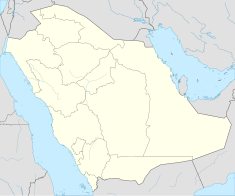
Ghawar (Arabic: الغوار) is an oil field located in Al-Ahsa Governorate, Eastern Province, Saudi Arabia. Measuring 280 by 30 km (174 by 19 mi), it is by far the largest conventional oil field in the world, and accounts for more than half of the cumulative oil production of Saudi Arabia. Ghawar is entirely owned and operated by Saudi Aramco, the state run Saudi oil company. Relatively little technical information is publicly available, because the company and Saudi government closely guard field performance data and per-field production details. Available information is predominantly historical (pre-nationalization), from incidental technical publications, or anecdotal.
Ghawar occupies an anticline above a basement fault block dating to Carboniferous time, about 320 million years ago; Cretaceous tectonic activity, as the northeast margin of Africa began to impinge on southwest Asia, enhanced the structure. Reservoir rocks are Jurassic Arab-D limestones with exceptional porosity (as much as 35% of the rock in places), which is about 280 feet thick and occurs 6,000-7,000 feet beneath the surface. Source rock is the Jurassic Hanifa formation, a marine shelf deposit of mud and lime with as much as 5% organic material (1% to 7% is considered good oil source rock). The seal is an evaporitic package of rocks including impermeable anhydrite.
Historically, Ghawar has been subdivided into five production areas, from north to south: 'Ain Dar and Shedgum, 'Uthmaniyah, Hawiyah and Haradh. The major oasis of Al-Ahsa and the city of Al-Hofuf are located on Ghawar's east flank, corresponding to the 'Uthmaniyah production area. Ghawar was discovered in 1948 and put on stream in 1951. Some sources claim Ghawar peaked in 2005, though this is strongly contested by the field operators.
...
Wikipedia

