Gerra (Gambarogno)
| Gerra (Gambarogno) | ||
|---|---|---|
| Former municipality of Switzerland | ||
|
||
| Coordinates: 46°07′N 8°47′E / 46.117°N 8.783°ECoordinates: 46°07′N 8°47′E / 46.117°N 8.783°E | ||
| Country | Switzerland | |
| Canton | Ticino | |
| District | Locarno | |
| Municipality | Gambarogno | |
| Area | ||
| • Total | 3.14 km2 (1.21 sq mi) | |
| Elevation | 216 m (709 ft) | |
| Population | ||
| • Total | 305 | |
| • Density | 97/km2 (250/sq mi) | |
| Postal code | 6576 | |
| SFOS number | 5106 | |
| Surrounded by | Brissago, Caviano, Indemini, Pino sulla Sponda del Lago Maggiore (IT-VA), Ronco sopra Ascona, San Nazzaro, Sant'Abbondio | |
| Website | SFSO statistics |
|
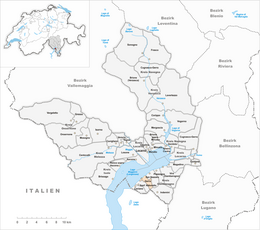
Gerra (Gambarogno) is a former municipality in the district of Locarno in the canton of Ticino in Switzerland.
On 25 April 2010, the former municipalities of Caviano, Contone, Gerra Gambarogno, Indemini, Magadino, Piazzogna, San Nazzaro, Sant'Abbondio and Vira Gambarogno merged in the new municipality of Gambarogno.
The name Gerra is probably from the 18th Century, when the village of Ronco de Martignoni (which was first mentioned in 1591) expanded into the Gerra river delta and the shores of Lake Maggiore.
Gerra was part of the old Vicinanza of Gambarogno. In the 16th Century, Ronco de Martignoni, Ronco di Sopra and Scimiana joined together to form an independent municipality. This municipality is listed in the register of lands of the parish of S. Abbondio from 1596. In 1744, the St. Rochus and Sebastian parish church was built.
Of the three inhabited settlement cores, Scimiana has remained nearly unchanged. The network of narrow streets and typical Gambarogno style alleys have been preserved, while most of the wooden balconies are gone and the fishermen's houses have disappeared. At the beginning of the 21st Century more than half the working population is employed in the services sector, and most work outside of the municipality.
Gerra has an area, as of 1997[update], of 3.14 square kilometers (1.21 sq mi). Of this area, 0.31 km2 (0.12 sq mi) or 9.9% is used for agricultural purposes, while 2.64 km2 (1.02 sq mi) or 84.1% is forested. Of the rest of the land, 0.28 km2 (0.11 sq mi) or 8.9% is settled (buildings or roads), 0.06 km2 (15 acres) or 1.9% is either rivers or lakes and 0.07 km2 (17 acres) or 2.2% is unproductive land.
...
Wikipedia


