Geography of Nauru

map of the island of Nauru
|
|
| Geography | |
|---|---|
| Location | Pacific Ocean |
| Coordinates | 0°32′S 166°55′E / 0.533°S 166.917°E |
| Area | 21 km2 (8.1 sq mi) |
| Highest elevation | 61 m (200 ft) |
| Highest point | unnamed |
| Administration | |
|
Nauru
|
|
| Largest settlement | Yaren (pop. 1,100) |
| Demographics | |
| Population | 9,488 (2012) |
| Pop. density | 441.67 /km2 (1,143.92 /sq mi) |
| Ethnic groups | Nauruan people |
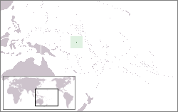
Nauru is a tiny phosphate rock island nation located in the South Pacific Ocean south of the Marshall Islands in Oceania. It is only 53 kilometres (33 mi) south of the Equator at coordinates 0°32′S 166°55′E / 0.533°S 166.917°E. Nauru is one of the three great phosphate rock islands in the Pacific Ocean — the others are Banaba (Ocean Island) in Kiribati and Makatea in French Polynesia.
Its land area is 21 km2 (8.1 sq mi), and it has a 30-kilometre coastline (19 mi). Maritime claims are a 200-nautical-mile (370 km) exclusive fishing zone, and a 12-nautical-mile (22 km) territorial sea.
The climate is tropical with a monsoonial rainy season from November to February.
A sandy beach rises to the fertile ring around raised coral reefs. The raised phosphate plateau ('Topside') takes up the central portion of the island. The highest point is 200 ft (61 m) above sea level, along the plateau rim.
Nauru's only economically significant natural resources are phosphates, formed from guano deposits by seabirds over many thousands of years, and fisheries, particularly for tuna.
Due to being surrounded by corals and sandy beaches, the island houses no natural harbours, nor any rivers or substantial lakes.
...
Wikipedia

