Geography of Antarctica
 |
|
| Continent | Antarctica |
|---|---|
| Coordinates | 80°S 90°E / 80°S 90°E |
| Area | Ranked 2nd (unofficially) |
| • Total | 14,000,000 km2 (5,400,000 sq mi) |
| • Land | 100% |
| • Water | 0% |
| Coastline | 17,968 km (11,165 mi) |
| Borders | No land boundaries |
| Highest point | Vinson Massif, 4,897 m (16,066 ft) |
| Lowest point | Bentley Subglacial Trench, −2,555 m (−8,382.5 ft) |
| Longest river | Onyx River, 25 km |
| Largest lake | Lake Vostok, 26,000 sq m (est.) |
| Climate | subantarctic to antarctic |
| Terrain | ice and barren rock |
| Natural Resources | krill, fin fish, crab |
| Natural Hazards | high winds, blizzards, cyclonic storms, volcanism |
| Environmental Issues | depleting ozone layer, rising sea level |
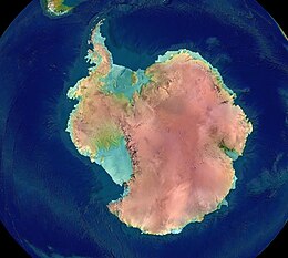
The geography of Antarctica is dominated by its south polar location and, thus, by ice. The Antarctic continent, located in the Earth's southern hemisphere, is centered asymmetrically around the South Pole and largely south of the Antarctic Circle. It is washed by the Southern (or Antarctic) Ocean or, depending on definition, the southern Pacific, Atlantic, and Indian Oceans. It has an area of more than 14 million km².
Some 98% of Antarctica is covered by the Antarctic ice sheet, the world's largest ice sheet and also its largest reservoir of fresh water. Averaging at least 1.6 km thick, the ice is so massive that it has depressed the continental bedrock in some areas more than 2.5 km below sea level; subglacial lakes of liquid water also occur (e.g., Lake Vostok). Ice shelves and rises populate the ice sheet on the periphery.
Physically, Antarctica is divided in two by Transantarctic Mountains close to the neck between the Ross Sea and the Weddell Sea. Western Antarctica and Eastern Antarctica correspond roughly to the eastern and western hemispheres relative to the Greenwich meridian. This usage has been regarded as Eurocentric by some, and the alternative terms Lesser Antarctica and Greater Antarctica (respectively) are sometimes preferred.
...
Wikipedia
