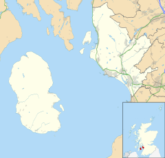
Gateside, North Ayrshire
| Gateside | |
|---|---|
 Gateside Primary School |
|
| Gateside shown within North Ayrshire | |
| Council area | |
| Lieutenancy area | |
| Country | Scotland |
| Sovereign state | United Kingdom |
| Dialling code | 01505 |
| Police | Scottish |
| Fire | Scottish |
| Ambulance | Scottish |
| EU Parliament | Scotland |
| UK Parliament | |
| Scottish Parliament | |
Gateside is a small village in North Ayrshire, Scotland about half a mile east of Beith on the B777.
Gateside Primary School was opened in 1903, and nowadays it has 74 pupils (2009). The school has an extension built in 1998 which provided indoor toilets and a school hall, which is used by the nursery, PE classes, and for school dinners and assemblies. Another extension is to be built soon. The school is very environmentally aware and has achieved its Green Flag Award (2009). Spier's school stood nearby and the grounds are now a public park used by the Gateside and Beith communities.
The Isabel Patrick Memorial Hall is a building in the Gothic style. Trearne House stood near Gateside, but it was demolished and the site is now a large worked out limestone quarry.
A field behind the primary school was given to the community by the Marshall family who were the village blacksmiths for many years.
The meaning of Powgree, Gateside's burn, is suggested as being 'Stream of the herd (of deer)'.
Gateside Memorial Hall.
Memorial to Isabel Ralston Patrick of Trearne who died aged 19 years.
A highly carved mantelpiece in Gateside Memorial Hall.
The old driveway that led to Trearne House.
The village inn and mainstreet.
A Moot hill or Court Hill survives near Gateside at Bog hall in the old Barony of Beith. Dobie states that the Abbot of Kilwinning used it to administered justice to his vassals & tenants. It is a sub-oval, flat-topped mound, situated at the foot of a small valley. A number of large stones are visible in the sides of the mound. It is turf-covered, situated on a low outcrop, and is mostly an artificial work. It pre-dates the channelling of the Boghall Burn which detours around it, the mound was probably isolated in this once marshy outflow of the former Boghall Loch (see NS35SE 14).Hill of Beith Castle, a square tower castle, once held by the Cunninghame family, stood near to the moot hill.
Loch Brand or Bran was the name by which Boghall Loch was formerly known. The loch, drained in 1780, is one of the main sources of the Powgree Burn and lay on the lands of Boghall and Hill o'Beith. In the bottom of the loch piles, stakes of oak or elm have been found and it is thought that these may be the remains of crannogs. The site is now represented by a low, marsh and reed covered area (less than 2 ha in extent) centred at NS 358 543 on the OS map.
...
Wikipedia

