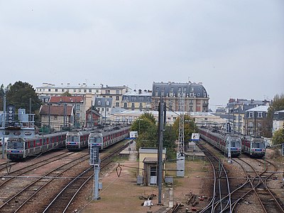
Gare de Versailles - Rive Droite
| Transilien commuter rail station | |||||||||||
 |
|||||||||||
| Location |
40 rue du Maréchal Foch |
||||||||||
| Coordinates | 48°48′35″N 2°8′5″E / 48.80972°N 2.13472°E | ||||||||||
| Owned by | RFF / SNCF | ||||||||||
| Line(s) |
|
||||||||||
| Platforms | 1 central | ||||||||||
| Tracks | 2 at platform + 9 siding | ||||||||||
| Connections | bus | ||||||||||
| Other information | |||||||||||
| Fare zone | 4 | ||||||||||
| History | |||||||||||
| Opened | 4 August 1839 | ||||||||||
| Traffic | |||||||||||
| Passengers | 17000 | ||||||||||
| Services | |||||||||||
|
|||||||||||
40 rue du Maréchal Foch
Versailles-Rive-Droite (French pronunciation: [veʁsaij ʁiv dʁwat]) is a railway station in the Parisian suburb of Versailles (department of Yvelines). It is located in the Île-de-France region of France and is part of the Transilien rail network, on the Paris-Saint-Lazare – Versailles-Rive-Droite line. The western terminus of that line, it is situated in the Notre-Dame section of the town.
The name "Rive-Droite" refers to the trains' Paris destination (Saint-Lazare) being on the right bank of the Seine.
James Mayer de Rothschild received the concession to build a rail line from Paris to Versailles. Designed by state engineers, the line shared a common trunk from Gare Saint-Lazare to Asnières-sur-Seine. The line was opened by the sons of Louis-Philippe on 2 August 1839.
The station was designed by the architect Alfred Armand.
The station is served by line L trains of the Transilien Paris - Saint Lazare network. It is the terminus of the eponymous branch of the Transilien L South network.
It is one of five stations in Versailles. It is a terminal station with two tracks at platform, as well as six siding tracks and two yard leads, and serves as a coach yard for line L South.
...
Wikipedia

