Gardiners Creek Trail
| Gardiners Creek Trail | |
|---|---|

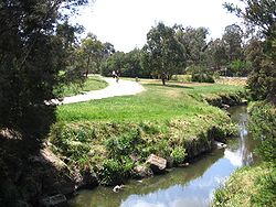
Gardiners Creek and Trail in Gardiners Reserve, Burwood
|
|
| Length | Approx 17 km |
| Location | Melbourne, Victoria, Australia |
| Cycling details | |
| Trail difficulty | Mostly easy |
| Hazards | Can be very crowded |
| Surface | Bitumen |
| Hills | Mostly flat |
| Water | Water fountains at several locations |
| Connecting transport | |
| Train(s) | Kooyong, East Malvern and Blackburn Stations |
The Gardiners Creek Trail is a shared use path for cyclists and pedestrians, which follows Gardiners Creek through the eastern suburbs of Melbourne, Victoria, Australia.
Bicycle Victoria is campaigning for a connection between Winton Road and Warrigal Road, to complete the gap in the trail at this point. It is proposed that the path would continue along the creek parallel to the Malvern Public Golf Course, spanning the gap from Winton Road to Warrigal Road.
The path begins as a branch of the Main Yarra Trail, opposite St Kevin's College and Scotch College, close to Kooyong railway station (on the Glen Waverley line); between the suburbs of Toorak, Hawthorn, and Kooyong. The path snakes along Gardiners Creek, near the Monash Freeway. It also goes past Solway Primary School.
Near Malvern East railway station it crosses Winton Road, and shortly after this point the path diverts. The branch to the right leads to a bridge over the Monash Freeway and railway line, giving access to Malvern East railway station or continuing on to pick up the Scotchmans Creek Trail and [ Malvern East Station to Centre Rd Trail]]. The main Gardiners Creek Trail continues to the left, crossing the Solway Street Bridge that was rebuilt and opened in late 2011 after being washed away by flood waters in February 2011. Over the bridge the path continues through a small parkland ending on Ryburne Avenue opposite the very southern end of the Anniversary Trail.
...
Wikipedia
