Gap, Pennsylvania
| Gap, Pennsylvania | |
|---|---|
| Census-designated place | |

Store in Gap
|
|
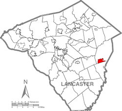
 Location in Lancaster County |
|
| Location in Pennsylvania | |
| Coordinates: 39°59′14″N 76°01′14″W / 39.98722°N 76.02056°WCoordinates: 39°59′14″N 76°01′14″W / 39.98722°N 76.02056°W | |
| Country | United States |
| State | Pennsylvania |
| County | Lancaster |
| Township | Salisbury |
| Area | |
| • Total | 2.8 sq mi (7 km2) |
| • Land | 2.8 sq mi (7 km2) |
| • Water | 0.0 sq mi (0 km2) |
| Elevation | 545 ft (166 m) |
| Population (2010) | |
| • Total | 1,931 |
| Time zone | Eastern (EST) (UTC-5) |
| • Summer (DST) | EDT (UTC-4) |
| ZIP code | 17527 |
| Area code(s) | 717 |
| GNIS feature ID | 1175420 |
Gap is a census-designated place and community in Salisbury Township, Lancaster County, Pennsylvania with a zip code of 17527. The population was 1,931 at the 2010 census. U.S. Route 30 passes through the town, which is also the terminus for four Pennsylvania highways: 772, 741, 897, and the heavily used 41, which goes toward Wilmington, Delaware.
Gap lies approximately 18 miles east of Lancaster, Pennsylvania, and 53 miles west of Philadelphia.
Gap has a history which can be dated as far back as William Penn's first visits to the area. Isaac Taylor erected the first house in what would become the Gap in 1747. The area around Gap had a copper mine and what at the time was the only nickel mines in the United States.
A stretch of railroad line was laid through areas of Sadsbury Township and Salisbury Township, which portions of each township share the Gap ZIP code (17527) and the town name of Gap.
Pequea Avenue is among the most heavily traveled roads in Gap. The Gap Fire Co. is located along this street. Gap Fire Company. The fire company was originally located atop Pequea Avenue by their water refilling area. The original fire house was renovated into a home that is leased out. A new facility was built to house all of the rescue trucks. the fire house is also used to host many fundraisers and civic gatherings. Up the street another block is a very historic building which was used for the Pequea Feeds Company.
Pennsylvania Route 41 connects central Gap to Newport, Delaware, and begins a block east of Pequea Avenue at the intersection of US 30, also known as the Lincoln Highway. Route 41 is the highway that connects the north to the south. It is a very relied-on route for commercial transporters who do not want to travel out to Philadelphia's bridges to deliver goods to the Northern states. In 1997 a study was conducted which said that PA 41 is the 3rd most deadly highway in the United States..
...
Wikipedia


