Friars Point
| Friars Point, Mississippi | |
|---|---|
| Town | |
 |
|
 Location of Friars Point, Mississippi |
|
| Location in the United States | |
| Coordinates: 34°21′58″N 90°38′13″W / 34.36611°N 90.63694°WCoordinates: 34°21′58″N 90°38′13″W / 34.36611°N 90.63694°W | |
| Country | United States |
| State | Mississippi |
| County | Coahoma |
| Government | |
| • Mayor | Catherine Miller |
| Area | |
| • Total | 1.12 sq mi (2.91 km2) |
| • Land | 1.10 sq mi (2.85 km2) |
| • Water | 0.02 sq mi (0.06 km2) |
| Elevation | 174 ft (53 m) |
| Population (2010) | |
| • Total | 1,200 |
| • Estimate (2016) | 1,082 |
| • Density | 1,100/sq mi (410/km2) |
| Time zone | Central (CST) (UTC-6) |
| • Summer (DST) | CDT (UTC-5) |
| ZIP code | 38631 |
| Area code(s) | 662 |
| FIPS code | 28-26060 |
| GNIS feature ID | 0670205 |
Friars Point is a town in Coahoma County, Mississippi, United States. The population was 1,200 at the 2010 census, down from 1,480 at the 2000 census.
Situated on the Mississippi River, Friars Point was once a busy port town, and remains the only place in Coahoma County with public access to the river's shore.
Friars Point is one of two hypothesized locations where Spanish explorer Hernando de Soto may have crossed the Mississippi River (the other is Commerce, Mississippi).
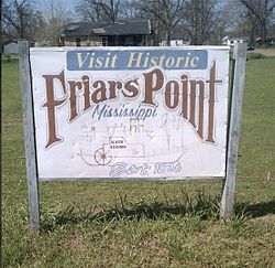
The town was founded in 1836 and originally called "Farrar's Point". When the town incorporated in 1852, its name was changed to "Friar's Point" to honor Robert Friar, an early settler, legislator, and businessman who sold fuel to passing steamboats. In 1850, the county seat was moved from the nearby town of Delta to Friars Point.
Strategically situated at a bend in the Mississippi River, Friars Point flourished before the Civil War as the largest shipping center for cotton south of Memphis.
During the Civil War, Union troops occupied and burned portions of the town. The Robinson-Slack-Marinelli House (now the Minie Ball House), which still stands and bears the mark of shelling from gunboats, was used as a headquarters by Union General Napoleon Bonaparte Buford. General William Tecumseh Sherman and Admiral David Dixon Porter used Friars Point as a rendezvous for 45 transport ships in December 1862, prior to attacking Vicksburg. Friars Point was also home to Confederate Brigadier General James L. Alcorn, whose grave and former plantation, Eagles Nest, are located a short distance east of the town. Alcorn turned from Whig to Republican after the war, and went on to become governor with the support of the large number of carpetbaggers who had settled in Friars Point.
...
Wikipedia

