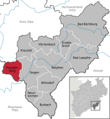
Freudenberg, Westphalia
| Freudenberg | ||
|---|---|---|
|
||
| Coordinates: 50°53′59″N 07°52′00″E / 50.89972°N 7.86667°ECoordinates: 50°53′59″N 07°52′00″E / 50.89972°N 7.86667°E | ||
| Country | Germany | |
| State | North Rhine-Westphalia | |
| Admin. region | Arnsberg | |
| District | Siegen-Wittgenstein | |
| Government | ||
| • Mayor | Eckhard Günther (CDU) | |
| Area | ||
| • Total | 54.48 km2 (21.03 sq mi) | |
| Elevation | 330 m (1,080 ft) | |
| Population (2015-12-31) | ||
| • Total | 17,929 | |
| • Density | 330/km2 (850/sq mi) | |
| Time zone | CET/CEST (UTC+1/+2) | |
| Postal codes | 57258 | |
| Dialling codes | 02734 | |
| Vehicle registration | SI | |
| Website | www.freudenberg-stadt.de | |
Freudenberg is a town in the Siegen-Wittgenstein district, in North Rhine-Westphalia, Germany.
The town lies on the German-Dutch holiday road called the Orange Route, joining towns, cities and regions associated with the House of Orange.
Freudenberg lies in hilly uplands between 243 and 505 m above sea level. The 17 constituent communities share roughly 55 km², of which two thirds is made up of broadleaf and spruce forest.
Besides the main town, which bears the same name as the whole municipality, there are sixteen outlying centres named Alchen, Bottenberg, Bühl, Büschergrund, Dirlenbach, Heisberg, Hohenhain, Lindenberg, Mausbach, Niederheuslingen, Niederholzklau, Niederndorf, Oberfischbach, Oberheuslingen, Oberholzklau and Plittershagen. Among these, the main town is the biggest, and the next in size after that is Büschergrund, which is itself further subdivided into four parts, named Büschen, Eichen, Anstoß and Bockseifen.
The town of Freudenberg in its current form came into being through municipal reform on 1 January 1969. Into it the seventeen formerly self-standing municipalities of Alchen, Bottenberg, Bühl, Büschergrund, Dirlenbach, Freudenberg, Heisberg, Hohenhain, Lindenberg, Mausbach, Niederheuslingen, Niederholzklau, Niederndorf, Oberfischbach, Oberheuslingen, Oberholzklau and Plittershagen were merged into one.
The oldest constituent communities are most likely the two that were both mentioned in documents in the 11th century, namely Plittershagen and Oberholzklau in 1079. Freudenberg is known to have been an Amt and court seat as of the early 15th century. The village and the castle of Freudenberg had their first documentary mention in 1389.
The castle was founded over the Weibe Valley together with a settlement by the Counts of Nassau as a corner post of their domain. Count Johann IV of Nassau, Vianden and Diez gave the Freudenberg townsfolk their "freedom rights" on 7 November 1456. This was a kind of minimal town rights, but the document bestowing this distinction upon the town is taken as evidence of town rights being granted Freudenberg. Documents give clues that Freudenberg was established quite early on as a "Flecken", or market town. The historic town core is even still called Alter Flecken (alt means "old"; –er is a grammatical inflection).
...
Wikipedia


