Freeport City
| City of Freeport | |
|---|---|
 |
|
| Nickname(s): The Industrial Capital The Second City |
|
| Coordinates: 26°31′42.5″N 78°41′47.7″W / 26.528472°N 78.696583°WCoordinates: 26°31′42.5″N 78°41′47.7″W / 26.528472°N 78.696583°W | |
| Country |
|
| Island |
|
| District | Freeport |
| Established | 1955 |
| Government | |
| • Type | District Council |
| • Chief Councillor | Chervita Campbell |
| • Deputy Chief Councillor | Lavar Smith |
| Area | |
| • City | 558 km2 (215 sq mi) |
| Elevation | 10 m (30 ft) |
| Population (2000) | |
| • City | 26,910 |
| • Density | 48/km2 (125/sq mi) |
| • Metro | 55,500 |
| Time zone | Eastern Time Zone (UTC-5) |
| Area code(s) | 242 |
| IATA airport code | FPO |
| ICAO airport code | MYGF |
| Website | http://gbpa.com/home/ |
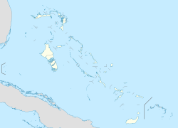
Freeport is a city, district and free trade zone on the island of Grand Bahama of the northwest Bahamas. In 1955, Wallace Groves, a Virginian financier with lumber interests in Grand Bahama, was granted 50,000 acres (20,234 ha) of pineyard with substantial areas of swamp and scrubland by the Bahamian government with a mandate to economically develop the area. Freeport has grown to become the second most populous city in the Bahamas.
The main airport serving the city is the Grand Bahama International Airport, which receives domestic flights from various islands of the Bahamas as well as several international flights from the United States and Canada. Freeport is also served by domestic Bahamian ferry services to other islands and by a regular international service to Fort Lauderdale, Florida, USA operated by Baleària Bahamas Express.
The Grand Bahama Port Authority (GBPA) operates the free trade zone, under the Hawksbill Creek Agreement signed in August 1955 whereby the Bahamian government agreed that businesses in the Freeport area would pay no taxes before 1980, later extended to 2054. The area of the land grants within which the Hawksbill Creek Agreement applies has been increased to 138,000 acres (55,847 ha)
Freeport is a 230-square-mile (600 km2) free trade zone on Grand Bahama Island, established in 1955 by the government of The Bahamas. The city of Freeport emerged from a land grant comprising 50,000 acres (200 km2) of swamp and scrub to become a cosmopolitan centre. The Grand Bahama Port Authority (GBPA) operates the free trade zone, under special powers conferred by the government under the Hawksbill Creek Agreement, which was recently extended until August 3, 2054. The agreement also increased the land grants to 138,000 acres (560 km2).
...
Wikipedia

