Grand Bahama
| Native name: Grand Bahamian | |
|---|---|

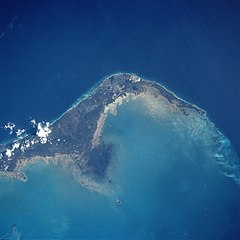
Western and central Grand Bahama seen from space, looking southwest
|
|
| Geography | |
| Location | Atlantic Ocean |
| Coordinates | 26°39′N 78°19′W / 26.650°N 78.317°W |
| Archipelago | Bahamas |
| Area | 1,373 km2 (530 sq mi) |
| Highest elevation | 40 ft (12 m) |
| Administration | |
| Largest settlement | Freeport |
| Demographics | |
| Population | 51,756 (2010) |
| Pop. density | 37.70 /km2 (97.64 /sq mi) |
Grand Bahama is the northernmost of the islands of the Bahamas, and the closest major island to the United States, lying 86 kilometres (53 mi) off of Palm Beach, Florida. It is the fourth largest island in the Bahamas island chain of approximately 700 islands and 2,400 cays. The island is approximately 153 kilometres (95 mi) long west to east and 24 kilometres (15 mi) at its widest point north to south. Administratively, the island consists of the Freeport Bonded Area and the districts of East Grand Bahama and West Grand Bahama.
The Spanish gave the island the name Gran Bajamar, meaning "Great Shallows", and what the eventual name of the Bahamas islands as a whole is derived from. However, the Lucayan (pre-Columbian) name for the island was Bahama. Grand Bahama's existence for almost two centuries was largely governed by the nature of these "great shallows" - the coral reefs surrounding the island were treacherous, and repelled its Spanish claimants (who largely left it alone apart from infrequent en route stops by ships for provisions) while attracting pirates, who would lure ships onto the reefs where they would run aground and be plundered. The Spaniards took little interest in the island after enslaving the native Lucayan inhabitants.
The islands were claimed by Great Britain in 1670. Piracy continued to thrive for at least half a century after the British takeover, though the problem was eventually brought under control.
Grand Bahama was to remain relatively quiet until the mid-nineteenth century, with only around 200-400 regular inhabitants in the capital, West End. In 1834, the towns of Pinder’s Point, Russell Town and Williams Town were established by former Bahamian slaves after the abolition of slavery in the British empire. The island remained under-developed until a brief boom in economic activity during the American Civil War, when it was a center for blockade runners smuggling goods (mostly weaponry, sugar and cotton) to the Confederacy. A second brief smuggling boom occurred during the years of prohibition in the USA.
...
Wikipedia

