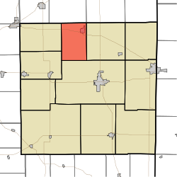
Franklin Township, Randolph County, Indiana
| Franklin Township | |
|---|---|
| Township | |
 |
|
| Coordinates: 40°15′53″N 85°03′21″W / 40.26472°N 85.05583°WCoordinates: 40°15′53″N 85°03′21″W / 40.26472°N 85.05583°W | |
| Country | United States |
| State | Indiana |
| County | Randolph |
| Government | |
| • Type | Indiana township |
| Area | |
| • Total | 24 sq mi (60 km2) |
| • Land | 23.93 sq mi (62.0 km2) |
| • Water | 0.07 sq mi (0.2 km2) |
| Elevation | 971 ft (296 m) |
| Population (2010) | |
| • Total | 1,265 |
| • Density | 52.9/sq mi (20.4/km2) |
| FIPS code | 18-25594 |
| GNIS feature ID | 453313 |
Franklin Township is one of eleven townships in Randolph County, Indiana. As of the 2010 census, its population was 1,265 and it contained 576 housing units.
Franklin Township was established in 1859.
According to the 2010 census, the township has a total area of 24 square miles (62 km2), of which 23.93 square miles (62.0 km2) (or 99.71%) is land and 0.07 square miles (0.18 km2) (or 0.29%) is water.
...
Wikipedia
