Franklin Township, Greene County, Pennsylvania
| Franklin Township, Greene County, Pennsylvania |
|
|---|---|
| Township | |

|
|
 Location of Franklin Township in Greene County |
|
 Location of Greene County in Pennsylvania |
|
| Country | United States |
| State | Pennsylvania |
| County | Greene |
| Area | |
| • Total | 40.6 sq mi (105.2 km2) |
| • Land | 40.6 sq mi (105.1 km2) |
| • Water | 0.04 sq mi (0.1 km2) |
| Population (2010) | |
| • Total | 7,280 |
| • Density | 179/sq mi (69.3/km2) |
| Time zone | EST (UTC-4) |
| • Summer (DST) | EDT (UTC-5) |
| Area code(s) | 724 |
| FIPS code | 42-059-27408 |
| Website | www |
Franklin Township is a township in Greene County, Pennsylvania, United States. The population was 7,280 at the 2010 census, down from 7,694 at the 2000 census.
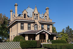
The Charles Grant Heasley House, Greene Hills Farm, Bridge in Franklin Township, and Thomas Kent, Jr., Farm are listed on the National Register of Historic Places.
The township is in central Greene County and surrounds the borough of Waynesburg, a separate municipality which is the county seat. The South Fork of Tenmile Creek, a tributary of the Monongahela River, flows from west to east through the center of the township and forms part of the border between the township and Waynesburg. According to the United States Census Bureau, the township has a total area of 40.6 square miles (105.2 km2), of which 40.6 square miles (105.1 km2) is land and 0.04 square miles (0.1 km2), or 0.09%, is water.
West Waynesburg and Morrisville are census-designated places within Franklin Township. Other unincorporated communities in the township are Rees Mill, East View, Brant Hill, and Blairtown. Interstate 79 passes north to south through the east side of the township, with access from Exit 14 (Pennsylvania Route 21) just east of Morrisville. Greene County Airport is in the northeast part of the township along PA 21 just east of I-79.
...
Wikipedia
