Franklin County, KY
| Franklin County, Kentucky | |
|---|---|

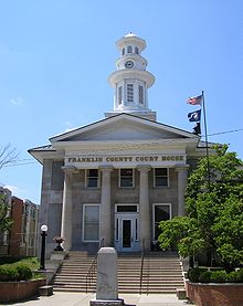
Franklin County courthouse in Frankfort
|
|
 Location in the U.S. state of Kentucky |
|
 Kentucky's location in the U.S. |
|
| Founded | May 10, 1795 |
| Named for | Benjamin Franklin |
| Seat | Frankfort |
| Largest city | Frankfort |
| Area | |
| • Total | 212 sq mi (549 km2) |
| • Land | 208 sq mi (539 km2) |
| • Water | 4.3 sq mi (11 km2), 2.0% |
| Population | |
| • (2010) | 49,285 |
| • Density | 237/sq mi (92/km²) |
| Congressional district | 6th |
| Time zone | Eastern: UTC-5/-4 |
| Website | franklincounty |
Franklin County is a county located in the U.S. state of Kentucky. As of the 2010 census, the population was 49,285. Its county seat is Frankfort, the state capital. The county was formed in 1795 from parts of Woodford, Mercer and Shelby counties, and was named after the American inventor and statesman Benjamin Franklin.
Franklin County is part of the Frankfort, Kentucky Micropolitan Statistical Area.
The three original counties of Kentucky (Jefferson, Fayette and Lincoln counties) intersected in what is today Franklin County. Franklin County was established in 1795 from land given by Mercer, Shelby, and Woodford counties. Franklin was the 18th Kentucky county in order of formation.
According to the U.S. Census Bureau, the county has a total area of 212 square miles (550 km2), of which 208 square miles (540 km2) is land and 4.3 square miles (11 km2) (2.0%) is water.
Franklin County's voter registration is overwhelmingly Democratic. Registered Democrats outnumber Republicans by a ratio of more than 4 to 1. However, in national elections the county has supported both Democrats and Republicans. In 2000 Democrat Al Gore won 50% of the vote to Republican George W. Bush's 47%. In 2004, Bush won 50% of the vote to Democrat John Kerry's 48%. In 2008 Republican John McCain defeated Democrat Barack Obama 49.47% to 48.87%, a difference of only 144 votes.
...
Wikipedia
