Franklin County, Georgia
| Franklin County, Georgia | |
|---|---|

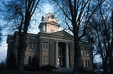
Franklin County Courthouse in Carnesville
|
|
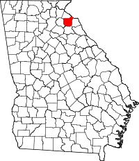
 Location in the U.S. state of Georgia |
|
 Georgia's location in the U.S. |
|
| Founded | 25 February, 1784 |
| Named for | Benjamin Franklin |
| Seat | Carnesville |
| Largest city | Lavonia |
| Area | |
| • Total | 266 sq mi (689 km2) |
| • Land | 261 sq mi (676 km2) |
| • Water | 5.0 sq mi (13 km2), 1.15% |
| Population | |
| • (2010) | 22,084 |
| • Density | 84/sq mi (32/km²) |
| Congressional district | 9th |
| Time zone | Eastern: UTC-5/-4 |
| Website | www |
Franklin County is a county located in the U.S. state of Georgia. As of the 2010 census, the population was 22,084. The county seat is Carnesville. On February 25, 1784 Franklin and Washington became Georgia's eighth and ninth counties, with Franklin named in honor of patriot Benjamin Franklin.
In its original form, Franklin County included all of the territory now in Banks, Barrow, Clarke, Jackson, Oconee, and Stephens counties, and parts of the modern-day Gwinnett, Hall, Hart, and Madison counties, as well as three counties that are now part of South Carolina.
The Franklin County Industrial Building Authority, one of only seven created by a Georgia constitutional amendment, actively seeks and recruits new industries to the county. The Authority consists of seven members: each of the five mayors from the cities within Franklin County, and two at-large members selected by the Board of Commissioners.
According to the U.S. Census Bureau, the county has a total area of 266 square miles (690 km2), of which 261 square miles (680 km2) is land and 5.0 square miles (13 km2) (1.9%) is water.
The majority of Franklin County is located in the Broad River sub-basin of the Savannah River basin, with just the northeastern corner, north of Lavonia, located in the Tugaloo River sub-basin of the same Savannah River basin.
As of the census of 2000, there were 20,285 people, 7,888 households, and 5,695 families residing in the county. The population density was 77 people per square mile (30/km²). There were 9,303 housing units at an average density of 35 per square mile (14/km²). The racial makeup of the county was 89.49% White, 8.83% Black or African American, 0.21% Native American, 0.25% Asian, 0.02% Pacific Islander, 0.41% from other races, and 0.78% from two or more races. 0.92% of the population were Hispanic or Latino of any race.
...
Wikipedia
