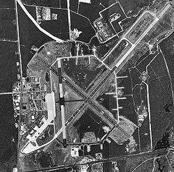
Francis S. Gabreski Airport
| Francis S. Gabreski Airport | |||||||||||||||||||
|---|---|---|---|---|---|---|---|---|---|---|---|---|---|---|---|---|---|---|---|

USGS aerial image, 8 April 1994
|
|||||||||||||||||||
| Summary | |||||||||||||||||||
| Airport type | Public / Military (ANG) | ||||||||||||||||||
| Owner | County of Suffolk | ||||||||||||||||||
| Serves | Westhampton Beach, New York | ||||||||||||||||||
| Elevation AMSL | 67 ft / 20 m | ||||||||||||||||||
| Coordinates | 40°50′37″N 072°37′54″W / 40.84361°N 72.63167°W | ||||||||||||||||||
| Website | www.co.suffolk.ny.us/... | ||||||||||||||||||
| Runways | |||||||||||||||||||
|
|||||||||||||||||||
| Statistics (2006) | |||||||||||||||||||
|
|||||||||||||||||||
|
Source: Federal Aviation Administration
|
|||||||||||||||||||
| Aircraft operations | 434,223 |
|---|---|
| Based aircraft | 107 |
Francis S. Gabreski Airport (IATA: FOK, ICAO: KFOK, FAA LID: FOK) is a county-owned, joint civil-military airport located 3 nautical miles (6 km) north of the central business district of Westhampton Beach, in Suffolk County, Long Island, New York, United States. It is approximately 80 miles (130 km) east of New York City.
Known as Suffolk County Air Force Base until 1969, then Suffolk County Airport until 1991, when it was renamed in honor of Colonel Francis S. Gabreski, USAF (Retired), a U.S. Army Air Forces flying ace in World War II who, as a U.S. Air Force officer, was later the commander of the 52nd Fighter-Interceptor Wing at Suffolk County Air Force Base from 1964 through November 1967, when he retired.
...
Wikipedia
