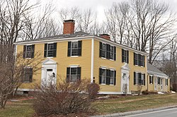
Francestown, New Hampshire
| Francestown, New Hampshire | |
|---|---|
| Town | |

|
|
 Location in Hillsborough County, New Hampshire |
|
| Coordinates: 42°59′15″N 71°48′45″W / 42.98750°N 71.81250°WCoordinates: 42°59′15″N 71°48′45″W / 42.98750°N 71.81250°W | |
| Country | United States |
| State | New Hampshire |
| County | Hillsborough |
| Incorporated | 1772 |
| Government | |
| • Board of Selectmen | Brad Howell, Chair Abigail Arnold Henry Kunhardt |
| • Town Administrator | Jamie A. Pike |
| Area | |
| • Total | 30.7 sq mi (79.5 km2) |
| • Land | 30.2 sq mi (78.1 km2) |
| • Water | 0.5 sq mi (1.4 km2) 1.73% |
| Elevation | 831 ft (253 m) |
| Population (2010) | |
| • Total | 1,562 |
| • Density | 51/sq mi (20/km2) |
| Time zone | Eastern (UTC-5) |
| • Summer (DST) | Eastern (UTC-4) |
| ZIP code | 03043 |
| Area code(s) | 603 |
| FIPS code | 33-27140 |
| GNIS feature ID | 0873598 |
| Website | www |
Francestown is a town in Hillsborough County, New Hampshire, United States. The population was 1,562 at the 2010 census.
Incorporated in 1772, Francestown takes its name from Frances Deering Wentworth, the wife of colonial governor John Wentworth. There were 928 residents when the first census was taken in 1790. For some time the town used its location on the only route between Boston and Vermont, the Second New Hampshire Turnpike, to collect a toll of one cent per mile from coaches and wagons. High-quality soapstone was mined in Francestown until the 1890s.
According to the United States Census Bureau, the town has a total area of 30.7 square miles (80 km2), of which 30.2 square miles (78 km2) is land and 0.5 square miles (1.3 km2) is water, making up 1.73% of the town. The highest point in Francestown is the summit of Crotched Mountain, at 2,066 feet (630 m) above sea level, on the town's western border. Francestown lies fully within the Merrimack River watershed.
As of the census of 2000, there were 1,480 people, 552 households, and 418 families residing in the town. The population density was 49.1 people per square mile (18.9/km²). There were 656 housing units at an average density of 21.7 per square mile (8.4/km²). The racial makeup of the town was 97.30% White, 0.07% African American, 0.34% Native American, 0.27% Asian, 0.47% from other races, and 1.55% from two or more races. Hispanic or Latino of any race were 0.54% of the population.
...
Wikipedia
