Fountain City, Wisconsin
| Fountain City, Wisconsin | |
|---|---|
| City | |

WIS-35 through town
|
|
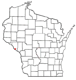
 Location of Fountain City, Wisconsin |
|
| Coordinates: 44°7′28″N 91°42′34″W / 44.12444°N 91.70944°WCoordinates: 44°7′28″N 91°42′34″W / 44.12444°N 91.70944°W | |
| Country | United States |
| State | Wisconsin |
| County | Buffalo |
| Area | |
| • Total | 5.57 sq mi (14.43 km2) |
| • Land | 4.29 sq mi (11.11 km2) |
| • Water | 1.28 sq mi (3.32 km2) |
| Elevation | 669 ft (204 m) |
| Population (2010) | |
| • Total | 859 |
| • Estimate (2012) | 842 |
| • Density | 200.2/sq mi (77.3/km2) |
| Time zone | Central (CST) (UTC-6) |
| • Summer (DST) | CDT (UTC-5) |
| Zip code | 54629 |
| Area code(s) | 608 |
| FIPS code | 55-26850 |
| GNIS feature ID | 1565171 |
Fountain City is a city in Buffalo County in the U.S. state of Wisconsin. The population was 859 at the 2010 census.
Fountain City was originally called Holmes' Landing, after Thomas Holmes, who settled there in 1839. Boats would stop at the landing to take on firewood, as well as water from springs not far from the river, leading to the name of Fountain City.
Fountain City is located at 44°7′28″N 91°42′34″W / 44.12444°N 91.70944°W (44.124506, -91.709470), at the intersection of highways 35 and 95.
According to the United States Census Bureau, the city has a total area of 5.57 square miles (14.43 km2), of which, 4.29 square miles (11.11 km2) is land and 1.28 square miles (3.32 km2) is water.
The city is located on a bend in the Mississippi River, where the river flows right at the base of the bluffs on the east side of the valley. Because of this, at some points the city is only two houses wide; one on each side of Wisconsin Highway 35. Eagle Creek and Waumandee Creek flow into Fountain City Bay northwest of the city limits. Eagle Creek flows around the base of Eagle Bluff, one of the tallest bluffs along the Mississippi.
The steep bluffs are characteristic of the Driftless Area of Wisconsin, Minnesota, and Iowa, a region that was not smoothed over by glacier like much of the rest of the midwest, but rather deeply cut by runoff from the rapidly melting glaciers.
As of the census of 2010, there were 859 people, 410 households, and 215 families residing in the city. The population density was 200.2 inhabitants per square mile (77.3/km2). There were 467 housing units at an average density of 108.9 per square mile (42.0/km2). The racial makeup of the city was 97.0% White, 0.1% African American, 1.4% Native American, 0.1% Asian, 0.6% from other races, and 0.8% from two or more races. Hispanic or Latino of any race were 1.0% of the population.
...
Wikipedia
