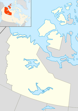
Fort Smith, Northwest Territories
|
Fort Smith Thebacha |
|
|---|---|
| Town | |
| Coordinates: 60°00′19″N 111°53′26″W / 60.00528°N 111.89056°WCoordinates: 60°00′19″N 111°53′26″W / 60.00528°N 111.89056°W | |
| Country | Canada |
| Territory | Northwest Territories |
| Region | South Slave Region |
| Constituency | Thebacha |
| Census division | Region 5 |
| Town | 1 October 1966 |
| Government | |
| • Mayor | Lynn Napier-Buckley |
| • Senior Administrative Officer | Keith Morrison |
| • MLA | Louis Sebert |
| Area (2011) | |
| • Total | 92.79 km2 (35.83 sq mi) |
| Elevation | 205 m (673 ft) |
| Population (2011) | |
| • Total | 2,496 |
| • Density | 26.7/km2 (69/sq mi) |
| Time zone | MST (UTC-7) |
| • Summer (DST) | MDT (UTC-6) |
| Postal code | X0E 0P0 |
| Area code(s) | 867 |
| Telephone Exchange | 872 621 870 |
| GNBC Code | LAILN |
| - Living cost | 132.5 |
| - Food price index | 108.5 |
| Climate | Dfc |
| NTS Map | 075D04 |
| Website | www |
| Sources: Department of Municipal and Community Affairs, Prince of Wales Northern Heritage Centre, Canada Flight Supplement ^A 2009 figure based on Edmonton = 100 ^B 2010 figure based on Yellowknife = 100 |
|
Fort Smith (Chipewyan language: Thebacha{Theh-baw-chaw} "beside the rapids") is a town in the South Slave Region of the Northwest Territories (NWT), Canada. It is located in the southeastern portion of the Northwest Territories, on the Slave River and adjacent to the NWT/Alberta border.
Fort Smith was founded around the Slave River. It served a vital link for water transportation between southern Canada and the Western Arctic. Early fur traders found an established portage route from what is now Fort Fitzgerald, on the western bank of the Slave River to Fort Smith. This route allowed its users to navigate the four sets of impassable rapids (Cassette Rapids, Pelican Rapids, Mountain Rapids, and Rapids of the Drowned). The portage trail had been traditionally used by local aboriginal people for centuries.
The aboriginal population of the region shifted as the fortunes of the tribes changed. By 1870, Cree had occupied the Slave River Valley. The Slavey had moved north by this time and the Chipewyan had also begun moving into the area.
Peter Pond of the North West Company was the first white trader to travel on the Slave River and make contact with aboriginal people in this region. He established a post on Lake Athabasca called Fort Chipewyan in the 1780s, at the head of the Slave River.
The fur trade penetrated deeper into the Mackenzie River district in the 19th century dominated by the activities of the Hudson's Bay Company. York boats were used to run the Slave River rapids and where needed small portages were established to bypass the most dangerous areas. Nonetheless, serious mishaps were bound to happen, and the section of the Slave River became known as 'The Rapids of the Drowned'. In 1872, the Hudson's Bay Company built an outpost called Smith's Landing at the most southern set of the Slave River rapids. In 1874, another outpost was constructed at the most northern set of rapids. It was called Fort Smith. Both posts were named in honour of Donald Alexander Smith.
...
Wikipedia

