Fort Mitchell, Kentucky
| Fort Mitchell, Kentucky | |
|---|---|
| City | |
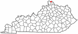
 Location of Fort Mitchell, Kentucky |
|
| Coordinates: 39°2′50″N 84°33′36″W / 39.04722°N 84.56000°WCoordinates: 39°2′50″N 84°33′36″W / 39.04722°N 84.56000°W | |
| Country | United States |
| State | Kentucky |
| County | Kenton |
| Incorporated | February 14, 1910 |
| Government | |
| • Type | Mayor-Council |
| • Mayor | Jude Hehman |
| Area | |
| • Total | 3.1 sq mi (8.1 km2) |
| • Land | 3.1 sq mi (8.1 km2) |
| • Water | 0.0 sq mi (0.0 km2) |
| Elevation | 853 ft (260 m) |
| Population (2010) | |
| • Total | 8,207 |
| • Density | 2,581.8/sq mi (996.8/km2) |
| Time zone | Eastern (EST) (UTC-5) |
| • Summer (DST) | EDT (UTC-4) |
| ZIP codes | 41011, 41017 |
| Area code(s) | 859 |
| FIPS code | 21-28558 |
| GNIS feature ID | 0492355 |
Fort Mitchell is a home rule-class city in Kenton County, Kentucky, in the United States. The population was 8,207 at the 2010 census.
Fort Mitchell is located at 39°2′50″N 84°33′36″W / 39.04722°N 84.56000°W (39.047221, -84.559993).
According to the United States Census Bureau, the city has a total area of 3.1 square miles (8.0 km2), all land.
Fort Mitchell was the site of one of seven Civil War fortifications built for the Defense of Cincinnati. The community was named for General Ormsby M. Mitchel, a professor at Cincinnati College (now the University of Cincinnati) who designed the fortifications.
Fort Mitchell was chartered as a city in 1910. It annexed South Ft. Mitchell (inc. 1927) in 1967 and Crescent Park in 1999.
Fort Mitchell is home to Beechwood Independent School District, a public K-12 institution and Blessed Sacrament, a Catholic K-8 institution. Although Dixie Heights High School has a Fort Mitchell mailing address, it is actually within the city limits of Edgewood. Beechwood High School was ranked #333 on the U.S. News & World Report 2015 list of best high schools nationwide.
...
Wikipedia
