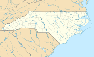
Fort Dobbs (North Carolina)
|
Fort Dobbs
|
|

Detail of a 1770 map of North Carolina by John Collett depicting the locations of Fort Dobbs, the Yadkin and Catawba Rivers, and Salisbury.
|
|
| Nearest city | Statesville, North Carolina |
|---|---|
| Coordinates | 35°49′18″N 80°53′42″W / 35.82167°N 80.89500°WCoordinates: 35°49′18″N 80°53′42″W / 35.82167°N 80.89500°W |
| Area | 9.5 acres (3.8 ha; 0.0148 sq mi) |
| Built | 1755–1756 |
| Architect | Arthur Dobbs, Hugh Waddell |
| Architectural style | Log blockhouse |
| MPS | Iredell County MRA (AD) |
| NRHP Reference # | 70000458 |
| Added to NRHP | September 15, 1970 |
Fort Dobbs was an 18th-century fort in the Yadkin–Pee Dee River Basin region of the Province of North Carolina, near what is now Statesville in Iredell County. Used for frontier defense during and after the French and Indian War, the fort was built to protect the British settlers of the western portion of what was then Rowan County, and served as a vital outpost for soldiers, traders, and colonial officials. Fort Dobbs' primary structure was a blockhouse with log walls, surrounded by a palisade and moat. It was intended to provide protection against Cherokee, Catawba, Shawnee, Delaware and French raids into North Carolina.
The fort's name honored Arthur Dobbs, the colonial Governor of North Carolina from 1754 to 1765, who played a role in designing the fort and authorized its construction. When in use, it was the only fort on the frontier between South Carolina and Virginia. Between 1756 and 1760, the blockhouse was garrisoned by a variable number of soldiers, many of whom were sent to fight in Pennsylvania and the Ohio River Valley during the French and Indian War. On February 27, 1760, the fort was the site of an engagement between Cherokee warriors and provincial soldiers that ended in a victory for the provincials. After this battle and other attacks by Cherokee warriors on British forts and settlements in the Anglo-Cherokee War, the southern British colonies launched a devastating counterattack against the Cherokee in 1760.
Fort Dobbs was abandoned after 1766, and disappeared from the landscape. Archaeological work in the 20th century and historical research in 2005 and 2006 led to the discovery of the fort's exact location and probable appearance. The site on which the fort sat is now operated by North Carolina's Division of State Historic Sites and Properties as Fort Dobbs State Historic Site, and supporters of the site have developed plans for the fort's reconstruction.
...
Wikipedia


