Forrest County, MS
| Forrest County, Mississippi | |
|---|---|
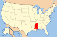
 Location in the U.S. state of Mississippi |
|
 Mississippi's location in the U.S. |
|
| Founded | 1908 |
| Named for | Nathan B. Forrest |
| Seat | Hattiesburg |
| Largest city | Hattiesburg |
| Area | |
| • Total | 470 sq mi (1,217 km2) |
| • Land | 466 sq mi (1,207 km2) |
| • Water | 3.9 sq mi (10 km2), 0.8% |
| Population | |
| • (2010) | 74,934 |
| • Density | 161/sq mi (62/km²) |
| Congressional district | 4th |
| Time zone | Central: UTC-6/-5 |
| Website | forrestcountyms |
Forrest County is a county located in the U.S. state of Mississippi. As of the 2010 census, the population was 74,934. Its county seat and largest city is Hattiesburg. The county was created from Perry County in 1908 and named in honor of Nathan B. Forrest, a Confederate general in the American Civil War. Forrest County is part of the Hattiesburg, MS Metropolitan Statistical Area.
According to the U.S. Census Bureau, the county has a total area of 470 square miles (1,200 km2), of which 466 square miles (1,210 km2) is land and 3.9 square miles (10 km2) (0.8%) is water.
As of the census of 2000, there were 72,604 people, 27,183 households, and 17,315 families residing in the county. The population density was 156 people per square mile (60/km²). There were 29,913 housing units at an average density of 64 per square mile (25/km²). The racial makeup of the county was 64.34% White, 33.55% Black or African American, 0.19% Native American, 0.74% Asian, 0.02% Pacific Islander, 0.40% from other races, and 0.75% from two or more races. 1.26% of the population were Hispanic or Latino of any race.
...
Wikipedia
