Floriano, Piauí
| Floriano | |||
|---|---|---|---|
| Municipality | |||
|
|||
| Nickname(s): Princesa do Sul | |||
| Motto: Labor signum nostrum est — Work is our sign | |||
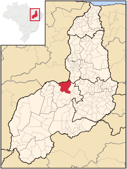
 Location of Floriano in the State of Piauí |
|||
 |
|||
| Coordinates: 6°46′01″S 43°01′22″W / 6.76694°S 43.02278°WCoordinates: 6°46′01″S 43°01′22″W / 6.76694°S 43.02278°W | |||
| Country |
|
||
| Region | Northeast | ||
| State |
|
||
| Founded | July 8, 1897 | ||
| Government | |||
| • Mayor | Gilberto Junior (/PMDB)) | ||
| Area | |||
| • Total | 3,409.664 km2 (1,316.479 sq mi) | ||
| Elevation | 112 m (367 ft) | ||
| Population (2008) | |||
| • Total | 57,700 | ||
| • Density | 17.2/km2 (45/sq mi) | ||
| (est. IBGE) | |||
| Time zone | -3 | ||
| HDI | 0.711 – medium | ||
| Website | [1] | ||
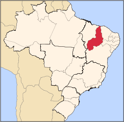
Floriano is a Brazilian municipality in the state of Piauí. It was founded by the Arabs and Syrians. It is situated in the physiographic zone of the Médio Parnaíba, on the right side of the Parnaíba River, in front of the city of Barão de Grajaú, in the Maranhão. It is also intersected by the rivers Gurguéia and Itaueira.
...
Wikipedia


