Flinders Ranges
| Flinders Ranges | |
|---|---|

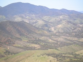
The Flinders Ranges from Devil's Peak
|
|
| Highest point | |
| Peak | St Mary Peak |
| Elevation | 1,171 m (3,842 ft) |
| Dimensions | |
| Length | 430 km (265 mi) north/south |
| Geography | |
| Country | Australia |
| State | South Australia |
| Range coordinates | 30°55′S 138°37′E / 30.92°S 138.62°ECoordinates: 30°55′S 138°37′E / 30.92°S 138.62°E |
The Flinders Ranges are the largest mountain range in South Australia, which starts about 200 km (125 mi) north of Adelaide. The discontinuous ranges stretch for over 430 km (265 mi) from Port Pirie to Lake Callabonna.
Its most characteristic landmark is Wilpena Pound, a large, sickle-shaped, natural amphitheatre that covers 80 km2 (31 sq mi), and contains the range's highest peak, St Mary Peak (1,171 m (3,842 ft),) which adjoins the Ikara-Flinders Ranges National Park. The northern ranges are protected by the Arkaroola Protection Area and the Vulkathunha-Gammon Ranges National Park. The southern ranges are notable for the Pichi Richi scenic railway and Mount Remarkable National Park.
Several small areas in the Ranges have protected area status. These include the Ikara-Flinders Ranges National Park near Wilpena Pound, the Mount Remarkable National Park in the south near Melrose, the Arkaroola Protection Area in the north, The Dutchmans Stern Conservation Park west of Quorn, and the Mount Brown Conservation Park south of Quorn. The Heysen Trail and Mawson Trail run for several hundred kilometres along the ranges, providing scenic long distance routes for walkers, cyclists and horse-riders.
...
Wikipedia

