Flåm
| Flåm | |
|---|---|
| Village | |

View of Aurlandsvangen and Flåm
|
|
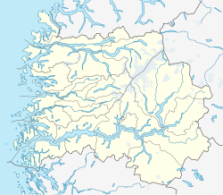
| Location in Sogn og Fjordane county | |
| Coordinates: 60°50′17″N 07°07′14″E / 60.83806°N 7.12056°ECoordinates: 60°50′17″N 07°07′14″E / 60.83806°N 7.12056°E | |
| Country | Norway |
| Region | Western Norway |
| County | Sogn og Fjordane |
| District | Sogn |
| Municipality | Aurland |
| Elevation | 59 m (194 ft) |
| Time zone | CET (UTC+01:00) |
| • Summer (DST) | CEST (UTC+02:00) |
| Post Code | 5743 Flåm |
Flåm is a village in Flåmsdalen, at the inner end of the Aurlandsfjorden—a branch of Sognefjorden. The village is located in the municipality of Aurland in Sogn og Fjordane county, Norway.
The name Flåm is documented as early as 1340 as Flaam. It is derived from the plural dative form of the Old Norse word flá meaning "plain, flat piece of land", and it refers to the flood plains of the Flåm River. ("A plain between steep mountains" is the toponomy of the encyclopedia Store Norske Leksikon.)
In 1670 Flåm Church was built.
In 1923 the construction of the Flåm Line was financed by parliament. (In 1908, the decision to build the line was made.)
In 1942 ordinary operation of (steam powered) trains started on the Flåm Line.
"In the 1960s, cruise ships stayed on the fjord" [without reaching the port], according to Dagens Næringsliv.
In 2000, the "new pier" was referred to in a government document. ("The pier was built at the entrance to the new millennium", according to Dagens Næringsliv.)
In 2014 its inhabitants numbered 350.
The closest airport is Sogndal Airport, Haukåsen, approximately 70 kilometres from Flåm.
The European route E16 highway between Oslo and Bergen runs through Flåm.
The village is located along the European route E16 highway, about 7 kilometres (4.3 mi) southwest of the municipal centre of Aurlandsvangen, 12 kilometres (7.5 mi) south of the village of Undredal, and 15 kilometres (9.3 mi) east of the village of Gudvangen (through the Gudvanga Tunnel).
...
Wikipedia


