Fiskdale, Massachusetts
| Fiskdale, Massachusetts | |
|---|---|
| CDP | |

Blackington Building
|
|
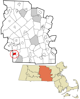
 Location in Worcester County and the state of Massachusetts. |
|
| Coordinates: 42°6′54″N 72°6′42″W / 42.11500°N 72.11167°WCoordinates: 42°6′54″N 72°6′42″W / 42.11500°N 72.11167°W | |
| Country | United States |
| State | Massachusetts |
| County | Worcester |
| Area | |
| • Total | 3.3 sq mi (8.5 km2) |
| • Land | 3.2 sq mi (8.3 km2) |
| • Water | 0.1 sq mi (0.3 km2) |
| Elevation | 627 ft (191 m) |
| Population (2010) | |
| • Total | 2,583 |
| • Density | 780/sq mi (300/km2) |
| Time zone | Eastern (EST) (UTC-5) |
| • Summer (DST) | EDT (UTC-4) |
| ZIP code | 01518 |
| Area code(s) | 508 |
| FIPS code | 25-23840 |
| GNIS feature ID | 0610057 |
Fiskdale (or Fiskedale) is a census-designated place (CDP) in the town of Sturbridge in Worcester County, Massachusetts, United States. The population was 2,583 at the 2010 census.
Fiskdale is located at 42°6′54″N 72°6′42″W / 42.11500°N 72.11167°W (42.114994, -72.111547).
According to the United States Census Bureau, the CDP has a total area of 8.5 km² (3.3 mi²). 8.3 km² (3.2 mi²) of it is land and 0.3 km² (0.1 mi²) of it (3.04%) is water.
Fiskdale is generally regarded by residents of Sturbridge to include the northwestern corner of the town, containing Tantasqua Regional High School,the densely populated areas around Route 148 (Brookfield Road), Holland Road area, as well as much of Route 20 to the west of Interstate 84. Big Alum Pond, Long Pond, and part of East Brimfield Lake are located in Fiskdale.
As of the census of 2000, there were 2,156 people, 873 households, and 568 families residing in the CDP. The population density was 261.0/km² (676.8/mi²). There were 914 housing units at an average density of 110.6/km² (286.9/mi²). The racial makeup of the CDP was 95.87% White, 0.60% African American, 0.60% Native American, 0.42% Asian, 0.09% Pacific Islander, 0.93% from other races, and 1.48% from two or more races. Hispanic or Latino of any race were 2.23% of the population.
...
Wikipedia
