Finnøy
| Finnøy kommune | |||
|---|---|---|---|
| Municipality | |||

View of the shorelines of Ombo in Finnøy
|
|||
|
|||
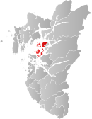
 Finnøy within Rogaland |
|||
| Coordinates: 59°09′53″N 05°49′46″E / 59.16472°N 5.82944°ECoordinates: 59°09′53″N 05°49′46″E / 59.16472°N 5.82944°E | |||
| Country | Norway | ||
| County | Rogaland | ||
| District | Ryfylke | ||
| Administrative centre | Judaberg | ||
| Government | |||
| • Mayor (2015) | Henrik Halleland (KrF) | ||
| Area | |||
| • Total | 104.41 km2 (40.31 sq mi) | ||
| • Land | 102.90 km2 (39.73 sq mi) | ||
| • Water | 1.51 km2 (0.58 sq mi) | ||
| Area rank | 379 in Norway | ||
| Population (2015) | |||
| • Total | 3,147 | ||
| • Rank | 262 in Norway | ||
| • Density | 30.6/km2 (79/sq mi) | ||
| • Change (10 years) | 13.5% % | ||
| Demonym(s) | Finnøying | ||
| Time zone | CET (UTC+1) | ||
| • Summer (DST) | CEST (UTC+2) | ||
| ISO 3166 code | NO-1141 | ||
| Official language form | Nynorsk | ||
| Website | www |
||
|
|
|||
Finnøy is an island municipality in Rogaland county, Norway. It is located in the traditional district of Ryfylke. The administrative centre of the municipality is the village of Judaberg.
The municipality consists of a number of islands on the south side of the Boknafjorden, about 24 kilometres (15 mi) northeast of the city of Stavanger. The Finnøy Tunnel connects the two islands of Finnøy and Talgje to the mainland. The rest of the islands are accessible only by boat.
Finnøy is an agricultural community dominated by dairy, meat, poultry, and fish farming products, with strong horticultural traditions, mainly greenhouse production of tomatoes, as well as some tourism.
The parish of Finnø was established as a municipality on 1 January 1838 (see formannskapsdistrikt). It originally encompassed the islands of Finnøy, Talgje, and Fogn as well as the small surrounding islets and the southeastern-most corner of the island of Rennesøy. On 1 January 1918, the part of Finnøy located on the island of Rennesøy (population: 72) was transferred from Finnøy to the neighboring municipality of Rennesøy.
...
Wikipedia


