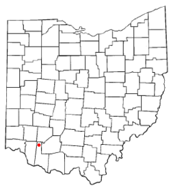
Fayetteville, Ohio
| Fayetteville, Ohio | |
|---|---|
| Village | |
 Location of Fayetteville, Ohio |
|
 Location of Fayetteville in Brown County |
|
| Coordinates: 39°11′13″N 83°55′55″W / 39.18694°N 83.93194°WCoordinates: 39°11′13″N 83°55′55″W / 39.18694°N 83.93194°W | |
| Country | United States |
| State | Ohio |
| County | Brown |
| Township | Perry |
| Area | |
| • Total | 0.52 sq mi (1.35 km2) |
| • Land | 0.52 sq mi (1.35 km2) |
| • Water | 0 sq mi (0 km2) |
| Elevation | 948 ft (289 m) |
| Population (2010) | |
| • Total | 330 |
| • Estimate (2012) | 326 |
| • Density | 634.6/sq mi (245.0/km2) |
| Time zone | Eastern (EST) (UTC-5) |
| • Summer (DST) | EDT (UTC-4) |
| ZIP code | 45118 |
| Area code(s) | 513 |
| FIPS code | 39-26796 |
| GNIS feature ID | 1040400 |
Fayetteville is a village in Brown County, Ohio, United States. The population was 330 at the 2010 census.
Fayetteville is known to have multiple speed traps at all four corners of town.
In 1883, Fayetteville contained two churches, two schools, two hotels, several stores and saloons, and two drug stores.
Fayetteville is located at 39°11′13″N 83°55′55″W / 39.18694°N 83.93194°W (39.186870, -83.932083).
According to the United States Census Bureau, the village has a total area of 0.52 square miles (1.35 km2), all land. It also rests on a bend of the East Fork Little Miami River.
Aerial view of Fayetteville and surrounding countryside.
Fayetteville corporation limit sign
Looking west on Pike Street (US Highway 50)
Pike Street
Pike Street
Fayetteville Municipal Building and Police Department
Family Dollar and Skyline Chili
Perry Township Community Center
Fayetteville Fire and EMS Station
Fayetteville Library
Dollar General
Fayetteville Post Office
Fayetteville High School
Water tower
Water tower
St. Patrick Catholic Church
Fayetteville United Methodist Church
Fayetteville Cemetery
Fayetteville Cemetery
Fayetteville Perry Township Park
Fayetteville Perry Township Park
Fayetteville Perry Township Park
Fayetteville Perry Township Park
As of the census of 2010, there were 330 people, 128 households, and 85 families residing in the village. The population density was 634.6 inhabitants per square mile (245.0/km2). There were 157 housing units at an average density of 301.9 per square mile (116.6/km2). The racial makeup of the village was 99.4% White, 0.3% African American, and 0.3% from other races. Hispanic or Latino of any race were 1.2% of the population.
...
Wikipedia
