Farwell, Nebraska
| Farwell, Nebraska | |
|---|---|
| Village | |
| Motto: "Preserving The Past And Promoting The Future" | |
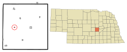
 Location of Farwell, Nebraska |
|
| Coordinates: 41°12′54″N 98°37′45″W / 41.21500°N 98.62917°WCoordinates: 41°12′54″N 98°37′45″W / 41.21500°N 98.62917°W | |
| Country | United States |
| State | Nebraska |
| County | Howard |
| Area | |
| • Total | 0.17 sq mi (0.44 km2) |
| • Land | 0.17 sq mi (0.44 km2) |
| • Water | 0 sq mi (0 km2) |
| Elevation | 1,998 ft (609 m) |
| Population (2010) | |
| • Total | 122 |
| • Estimate (2012) | 122 |
| • Density | 717.6/sq mi (277.1/km2) |
| Time zone | Central (CST) (UTC-6) |
| • Summer (DST) | CDT (UTC-5) |
| ZIP code | 68838 |
| Area code(s) | 308 |
| FIPS code | 31-16760 |
| GNIS feature ID | 0829280 |
Farwell is a village in Howard County, Nebraska, United States. The population was 122 at the 2010 census. It is part of the Grand Island, Nebraska Micropolitan Statistical Area.
Farwell was originally called Posen, and under the latter name was established in 1887 by a colony of Polish settlers. Some incoming Danish settlers soon found the name to their disliking, and so in 1889 it was changed to Farwell, the Danish word for "good-bye". Farwell was incorporated as a village in 1895.
Farwell is located at 41°12′54″N 98°37′45″W / 41.21500°N 98.62917°W (41.214969, -98.629274).
According to the United States Census Bureau, the village has a total area of 0.17 square miles (0.44 km2), all of it land.
As of the census of 2010, there were 122 people, 57 households, and 35 families residing in the village. The population density was 717.6 inhabitants per square mile (277.1/km2). There were 67 housing units at an average density of 394.1 per square mile (152.2/km2). The racial makeup of the village was 98.4% White, 0.8% Asian, and 0.8% from other races. Hispanic or Latino of any race were 3.3% of the population.
...
Wikipedia
