Farmingdale, New Jersey
| Farmingdale, New Jersey | |
|---|---|
| Borough | |
| Borough of Farmingdale | |

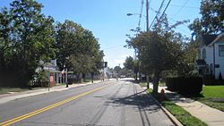
Downtown Farmingdale
|
|
| Motto: Today's Town with Yesterday's Touch | |
 Map of Farmingdale in Monmouth County. Inset: Location of Monmouth County highlighted in the State of New Jersey. |
|
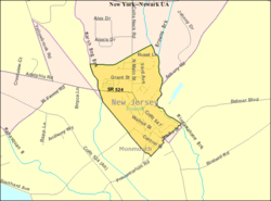
 Census Bureau map of Farmingdale, New Jersey |
|
| Coordinates: 40°12′05″N 74°10′04″W / 40.201391°N 74.167839°WCoordinates: 40°12′05″N 74°10′04″W / 40.201391°N 74.167839°W | |
| Country | |
| State |
|
| County | Monmouth |
| Incorporated | April 8, 1903 |
| Government | |
| • Type | Borough |
| • Body | Borough Council |
| • Mayor | James Daly (acting) (R, term ends December 31, 2019) |
| • Clerk | Jane L. Marban |
| Area | |
| • Total | 0.523 sq mi (1.354 km2) |
| • Land | 0.522 sq mi (1.351 km2) |
| • Water | 0.001 sq mi (0.002 km2) 0.18% |
| Area rank | 547th of 566 in state 48th of 53 in county |
| Elevation | 75 ft (23 m) |
| Population (2010 Census) | |
| • Total | 1,329 |
| • Estimate (2015) | 1,306 |
| • Rank | 524th of 566 in state 47th of 53 in county |
| • Density | 2,547.7/sq mi (983.7/km2) |
| • Density rank | 243rd of 566 in state 28th of 53 in county |
| Time zone | Eastern (EST) (UTC-5) |
| • Summer (DST) | Eastern (EDT) (UTC-4) |
| ZIP code | 07727 |
| Area code(s) | 732 exchanges: 751, 919, 938 |
| FIPS code | 3402522950 |
| GNIS feature ID | 0885218 |
| Website | farmingdaleborough |
Farmingdale is a borough in Monmouth County, New Jersey, United States. As of the 2010 United States Census, the borough's population was 1,329, reflecting a decline of 258 (-16.3%) from the 1,587 counted in the 2000 Census, which had in turn increased by 125 (+8.5%) from the 1,462 counted in the 1990 Census.
Farmingdale was incorporated as a borough by an act of the New Jersey Legislature on April 8, 1903, from portions of Howell Township. The borough is named for its location at the center of an agricultural area.
According to the United States Census Bureau, the borough had a total area of 0.523 square miles (1.354 km2), including 0.522 square miles (1.351 km2) of land and 0.001 square miles (0.002 km2) of water (0.18%).
The borough is completely surrounded by Howell Township, making it part of 21 pairs of "doughnut towns" in the state, where one municipality entirely surrounds another.
As of the census of 2010, there were 1,329 people, 547 households, and 341.9 families residing in the borough. The population density was 2,547.7 per square mile (983.7/km2). There were 578 housing units at an average density of 1,108.0 per square mile (427.8/km2). The racial makeup of the borough was 89.62% (1,191) White, 2.86% (38) Black or African American, 0.45% (6) Native American, 3.16% (42) Asian, 0.00% (0) Pacific Islander, 1.73% (23) from other races, and 2.18% (29) from two or more races. [[Hispanic (U.S. Census)|Hispanic or Latino of any race were 6.92% (92) of the population.
...
Wikipedia
