Fallon County, Montana
| Fallon County, Montana | |
|---|---|

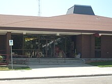
Fallon County Courthouse in Baker
|
|
 Location in the U.S. state of Montana |
|
 Montana's location in the U.S. |
|
| Founded | December 9, 1913 |
| Seat | Baker |
| Largest city | Baker |
| Area | |
| • Total | 1,623 sq mi (4,204 km2) |
| • Land | 1,621 sq mi (4,198 km2) |
| • Water | 2.3 sq mi (6 km2), 0.1% |
| Population (est.) | |
| • (2015) | 3,190 |
| • Density | 1.8/sq mi (1/km²) |
| Congressional district | At-large |
| Time zone | Mountain: UTC-7/-6 |
| Website | www |
Fallon County is a county located in the U.S. state of Montana. As of the 2010 census, the population was 2,890. Its county seat is Baker. The county was created in 1913 after being carved out of Custer County. The name comes from Benjamin O'Fallon, a nephew of Captain William Clark and an Indian agent for the upper Missouri region from 1823 to 1827.
According to the U.S. Census Bureau, the county has a total area of 1,623 square miles (4,200 km2), of which 1,621 square miles (4,200 km2) is land and 2.3 square miles (6.0 km2) (0.1%) is water.
As of the census of 2000, there were 2,837 people, 1,140 households, and 803 families residing in the county. The population density was 2 people per square mile (1/km²). There were 1,410 housing units at an average density of 1 per square mile (0/km²). The racial makeup of the county was 98.59% White, 0.14% Black or African American, 0.32% Native American, 0.35% Asian, 0.04% Pacific Islander, 0.11% from other races, and 0.46% from two or more races. 0.39% of the population were Hispanic or Latino of any race. 39.4% were of German, 16.9% Norwegian, 10.0% Irish and 8.2% English ancestry. 97.2% spoke English and 1.7% German as their first language.
...
Wikipedia
