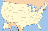
Fairfield County, CT
| Fairfield County, Connecticut | |
|---|---|
| County of Connecticut | |
| County of Fairfield | |

|
|
 Location in the U.S. state of Connecticut |
|
 Connecticut's location in the U.S. |
|
| Founded | 1666 |
| Seat | none; since 1960 Connecticut counties no longer have a county government Fairfield (1666–1853) Bridgeport (1853–1960) |
| Largest city | Bridgeport (population) Newtown (area) |
| Area | |
| • Total | 837 sq mi (2,168 km2) |
| • Land | 625 sq mi (1,619 km2) |
| • Water | 212 sq mi (549 km2) |
| Population (est.) | |
| • (2016) | 944,177 |
| • Density | 1,516.9/sq mi (585.7/km2) |
| Congressional districts | 3rd, 4th, 5th |
Fairfield County is the most southwestern and populous county of the U.S. state of Connecticut. As of the 2010 census, the county's population was 916,829, estimated to have increased by 2.9% to 944,177 in 2016. The county population represents a little over 25% of Connecticut's overall state population and is one of the fastest growing counties in the state. The county contains four of the state's largest cities (Bridgeport (1st), Stamford (3rd), Norwalk (6th) and Danbury (7th)), whose combined population of 433,368 is almost half the county's.
The United States Office of Management and Budget has designated Fairfield County as the Bridgeport-Stamford-Norwalk, CT Metropolitan Statistical Area. The United States Census Bureau ranked the Bridgeport-Stamford-Norwalk, CT Metropolitan Statistical Area as the 57th most populous metropolitan statistical area of the United States as of July 1, 2012. The Office of Management and Budget has further designated the Bridgeport-Stamford-Norwalk, CT Metropolitan Statistical Area as a component of the more extensive New York-Newark-Bridgeport, NY-NJ-CT-PA Combined Statistical Area, the most populous combined statistical area and primary statistical area of the United States.
...
Wikipedia
