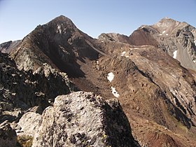
Estaragne
| Estaragne | |
|---|---|
 |
|
| Highest point | |
| Elevation | 3,006 m (9,862 ft) |
| Prominence | 84 metres (276 ft) |
| Coordinates | 42°47′50″N 0°07′46″E / 42.79722°N 0.12944°ECoordinates: 42°47′50″N 0°07′46″E / 42.79722°N 0.12944°E |
| Geography | |
|
|
|
| Parent range | Néouvielle massif (Pyrenees) |
The Estaragne (Pic d'Estaragne) is a French pyrenean summit, culminating at 3,006 m (9,862 ft) m.
The peak is located in the Hautes-Pyrénées department, in the Néouvielle massif, near Saint-Lary-Soulan in the Pyrenees National Park and near the Néouvielle National Nature Reserve.
The etymology of the name "Estaragne" is obscure, although there is a small valley and stream with the same name just to the northeast of the peak.
The peak itself is bare, but the upper slopes have a sub-alpine climate. Meadows predominate with patches of trees and shrubs. Snow cover usually starts in late October and lasts until June. the most common shrubs are Rhododendron ferrugineum and Vaccinium myrtillus; and the most common grasses are Nardus stricta and Festuca eskia.
There are at least two relatively easy summer access routes:
...
Wikipedia

