Erie International Airport
| Erie International Airport Tom Ridge Field |
|||||||||||||||
|---|---|---|---|---|---|---|---|---|---|---|---|---|---|---|---|
 |
|||||||||||||||
| Summary | |||||||||||||||
| Airport type | Public | ||||||||||||||
| Owner | Erie Regional Airport Authority | ||||||||||||||
| Serves | Erie, Pennsylvania | ||||||||||||||
| Location | Millcreek Township, Pennsylvania, United States | ||||||||||||||
| Elevation AMSL | 732 ft / 223 m | ||||||||||||||
| Coordinates | 42°4′59″N 80°10′55″W / 42.08306°N 80.18194°WCoordinates: 42°4′59″N 80°10′55″W / 42.08306°N 80.18194°W | ||||||||||||||
| Website | www |
||||||||||||||
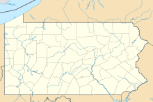
| Map | |||||||||||||||
| Location of airport in Pennsylvania / United States | |||||||||||||||
| Runways | |||||||||||||||
|
|||||||||||||||
| Statistics (2015) | |||||||||||||||
|
|||||||||||||||
| Passenger enplanements | 88,953 |
|---|
Erie International Airport Tom Ridge Field (IATA: ERI, ICAO: KERI, FAA LID: ERI) is a public airport five miles (8 km) southwest of Erie, in Erie County. Airline service at Erie faces stiff competition from the Pittsburgh, Cleveland and Buffalo airports, all within two hours of Erie by car. In 2004 Erie was the third fastest growing airport in the United States, and the fastest growing airport in Pennsylvania. It is also 128 miles (206 km) from Pittsburgh, 111 miles (179 km) from the Canada–US border, 95 miles (153 km) from Cleveland, Ohio and 105 miles (169 km) from Buffalo, New York.
In 1924, Roger Griswold purchased 22.12 acres (9.0 ha) of land 6 miles (10 km) west of Erie at the intersection of West Lake and Asbury Roads for use as an airfield. Soon after, a flight training school was based at the field. In 1927, as part of a nationwide tour by Charles Lindbergh after his transatlantic flight, Erie was selected as one of the cities where Lindbergh would make a brief stopover. However, as Griswold Field proved inadequate for the larger Spirit of St. Louis to land and an alternative site could not be located, a flyover by Lindbergh had to suffice. The affair illuminated the need for a proper airport and prompted the Erie City Council to examine to possibility of establishing a municipal airport. City Council was, initially, favoring a site 1⁄2-mile (0.8 km) east of Wesleyville for a municipal airport, however Lieutenant Jimmy Doolittle commented on the distance between it and the city; Dolittle noted that "you might as well take 40 minutes more and go on to Cleveland." After recommendations made by Lindbergh to a Congressional committee that no airport less than 1 square mile (2.6 km2) be approved, the planning commission for Erie's airport began to reevaluate the site they chose.
...
Wikipedia


