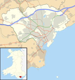
Ely, Cardiff
Ely
|
|
|---|---|
 Cowbridge Road West, Ely |
|
 |
|
| Ely shown within Cardiff | |
| Population | 14,603 (2011) |
| Community |
|
| Principal area | |
| Ceremonial county | |
| Country | Wales |
| Sovereign state | United Kingdom |
| Post town | CARDIFF |
| Postcode district | CF5 |
| Dialling code | 029 |
| Police | South Wales |
| Fire | South Wales |
| Ambulance | Welsh |
| EU Parliament | Wales |
| UK Parliament | |
| Welsh Assembly | |
Ely (Welsh Trelái tref town + Elái River Ely) is a community primarily dominated by council housing in western Cardiff, capital of Wales.
In Roman times, Ely was the site of a Roman villa, near the old racecourse. There is also thought to have been a Roman road near the site linking to Cardiff Roman Fort and eastwards to Newport.
In 1855, the first horse race took place at Ely Racecourse, which took over from the Great Heath racecourse.
The Ordnance Survey map from the early 1880s shows just how isolated the ancient Ely village was from the rest of Cardiff. Reports about travelling along the main road over Ely Common to Cardiff talk of pot holes and no shelter and a terrible journey on foot. Most of Ely was still farmland feeding Cardiff's population. A railway station had only recently been constructed, and this gave the surrounding area further potential for mass housing development.
The 'Ely Industrial School' on Cowbridge Road East was home to orphaned children originally from Cardiff. It had been set up to accommodate "pauper children" from 1863. It was very much a product of the Victorian age, and workhouse mentality, increased social awareness and responsibility saw it closing in 1903 and converted to additional workhouse accommodation for adults (though never used for that purpose), known as Ely Lodge. The children lived in what became as Ely Homes. The school was demolished some years later and an infectious diseases isolation unit was built on the same site.
The land was once owned by the Earl of Plymouth, who dictated that alcohol may not be sold on the land. As a result, like other plots of land with similar conditions, the boundaries of the old estate can be approximated by the locations of public houses around the area.
...
Wikipedia

