El Cajas
| Cajas National Park | |
|---|---|
|
IUCN category II (national park)
|
|

A lagoon in Cajas National Park
|
|
|
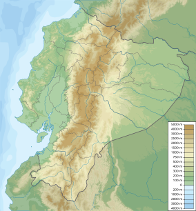
Location in Ecuador
|
|
| Location |
Ecuador Azuay Province |
| Nearest city | Cuenca |
| Coordinates | 02°51′S 79°15′W / 2.850°S 79.250°WCoordinates: 02°51′S 79°15′W / 2.850°S 79.250°W |
| Area | 285.4 km2 (110.2 sq mi) |
| Established | November 5, 1996 (Resolution N° 057) |
| Designated | 14 August 2002 |
Cajas National Park (Spanish: Parque Nacional Cajas) is a national park in the highlands of Ecuador. It is located about 30 km west from Cuenca, the capital of the province of Azuay. The area of 285.44 km2 (28,544 ha) between 3100m and 4450m above sea level offers a tundra vegetation on a jagged landscape of hills and valleys. It was declared a National Park on November 5, 1996 by resolution N° 057.
The name "Cajas" is derived from the Quichua word "cassa" meaning "gateway to the snowy mountains". or "caxa" (Quichua:cold). It has also been linked to the Spanish word "cajas" (boxes).
The highest point is the 4,450 m high Cerro Arquitectos (Architect's Hill) and the elevation of roads reach higher than 4,310 meters (13,550 feet). About 270 lakes and lagoons can be found in the páramo of Cajas. Luspa is the largest of these lake and extends over 78 hectars with a maximum depth of 68 m at a perimeter of 5,161 m. Like the other lakes it is of glacial origin and glaciation shaped the landscape of Cajas leaving U-shaped valleys and ravines. Cajas provides about 60% of the drinking water for the Cuenca area. Two of the four rivers of Cuenca originate from Cajas, the Tomebamba and Yanuncay rivers which eventually drain into the Amazon river. Also the Paute river links to the Amazon. As the park straddles the continental divide, its western drainage, the Balao and Cañar link to the Pacific ocean. The modern road crosses the continental divide at the pass "Tres Cruces" (4,167 m). This section is the most western part of the continental divide of South Americas.
The climate shows an average temperature of 13.2 °C and an average annual precipitation of 1,072 mm. Clouds typically drift up from the Pacific coast and from the Paute river basin (near Cuenca) and bring humidity.
...
Wikipedia

