Ein Hod
|
Ein Hod עֵין הוֹד |
|
|---|---|
 |
|
| Coordinates: 32°42′05″N 34°58′48″E / 32.70139°N 34.98000°ECoordinates: 32°42′05″N 34°58′48″E / 32.70139°N 34.98000°E | |
| District | Haifa |
| Council | Hof HaCarmel |
| Population (2015) | 590 |
| Name meaning | Spring of splendor |
| Website | ein-hod.org |
| Ayn Hawd | |
|---|---|

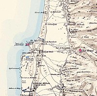
Map of Ayn Hawd and surrounding area, 1870s. The Survey of Western Palestine. London:Committee of the Palestine Exploration Fund
|
|
| Arabic | عين حوض |
| Name meaning | Spring of the cistern |
| Subdistrict | Haifa |
| Palestine grid | 148/234 |
| Population | 650 (1945) |
| Area | 12,605 dunams |
| Date of depopulation | 15 July 1948 |
| Cause(s) of depopulation | Military assault by Yishuv forces |
| Current localities | Ein HodNir Etzion |
Ein Hod (Hebrew: עֵין הוֹד) is a village in Haifa District in northern Israel. Located at the foot of Mount Carmel and southeast of Haifa, it falls under the jurisdiction of Hof HaCarmel Regional Council and has the status of communal settlement. In 2015 it had a population of 590.
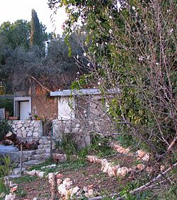
The village is situated on a hillside amidst olive groves, with a view of the Mediterranean Sea and a twelfth-century Crusader fortress. Prior to the 1948 Arab–Israeli War Ein Hod was the site of the Arab village of Ein Hawd. Most of the Arab inhabitants were expelled during the war, however some remained in the area and settled nearby, forming a new village, also by the name of Ein Hawd.
After a failed attempt to create a moshav on the site, Ein Hod became an artists' colony in 1953.
Excavations in the Carmel region indicate that human settlement in the area dates back over 150,000 years.
The village was one of the "Al-Hija" villages founded by relatives of Emir Hussam al-Din Abu al-Hija. Abu al-Hija ("the Daring") was an Iraqi Kurd and commander of the Kurdish forces that took part in Sultan Saladin's conquest of the Crusader Kingdom of Jerusalem in the 1180s. He was renowned for his bravery, and commanded the garrison of Acre at the time of the Siege of Acre (1189–1192).
...
Wikipedia

