Edward's Plateau
| Edwards Plateau | |
|---|---|

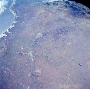
A photograph taken by NASA of the Edwards Plateau and Balcones Escarpment
|
|
 |
|
| Ecology | |
| Biome | Temperate grasslands, savannas, and shrublands |
| Bird species | 191 |
| Mammal species | 64 |
| Geography | |
| Country | United States |
| State | Texas |
| Conservation | |
| Habitat loss | 5.35% |
| Protected | 2.26% |
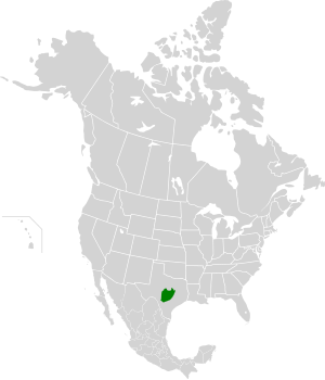
The Edwards Plateau is a region of west-central Texas which is bounded by the Balcones Fault to the south and east, the Llano Uplift and the Llano Estacado to the north, and the Pecos River and Chihuahuan Desert to the west.San Angelo, Austin, San Antonio and Del Rio roughly outline the area. The eastern portion of the plateau is known as the Texas Hill Country.
According to the Texas Parks and Wildlife Department, the following 41 counties comprise the Edwards Plateau:
The bedrock consists primarily of limestone, with elevations ranging between 100 and 3000 ft. Caves are numerous.
The landscape of the plateau is mostly savanna scattered with trees. It mostly lacks deep soil suitable for farming, though the soil is fertile mollisols and some cotton, grain sorghum and oats are grown. For the most part, though, the thin soil and rough terrain areas are primarily grazing regions, with cattle, sheep and Angora goats predominant. Several rivers cross the region, which generally flow to the south and east through the Texas Hill Country toward the Gulf of Mexico; springs occur (in wet years), but permanent surface water supplies are sparse throughout the area, except for man-made reservoirs. The area is well drained; rainwater flows into the Edwards Aquifer recharge zone at the south of the plateau to feed rivers to the south. Rainfall varies from 15 to 33 inches per year, on average, from northwest to southeast, and the area has a moderate temperature and a reasonably long growing season.
...
Wikipedia
