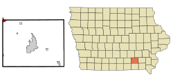
Eddyville, Iowa
| Eddyville, Iowa | |
|---|---|
| City | |
 Location of Eddyville, Iowa |
|
| Coordinates: 41°9′30″N 92°38′6″W / 41.15833°N 92.63500°WCoordinates: 41°9′30″N 92°38′6″W / 41.15833°N 92.63500°W | |
| Country |
|
| State |
|
| Counties | Wapello, Mahaska, Monroe |
| Area | |
| • Total | 1.18 sq mi (3.06 km2) |
| • Land | 1.18 sq mi (3.06 km2) |
| • Water | 0 sq mi (0 km2) |
| Elevation | 679 ft (207 m) |
| Population (2010) | |
| • Total | 1,024 |
| • Estimate (2012) | 1,021 |
| • Density | 867.8/sq mi (335.1/km2) |
| Time zone | Central (CST) (UTC-6) |
| • Summer (DST) | CDT (UTC-5) |
| ZIP code | 52553 |
| Area code(s) | 641 |
| FIPS code | 19-23970 |
| GNIS feature ID | 0456224 |
| Website | Eddyville |
Eddyville is a city in Mahaska, Monroe, and Wapello Counties in the U.S. state of Iowa. The population was 1,024 at the 2010 census.
Eddyville was founded by Jabish P. Eddy, in 1841, before Iowa became a state. It was a place for trade with the Indians and for pioneers to provision and ford the Des Moines river. The first commercial coal mines in Wapello County were opened near Eddyville. Local oral history has it that a two-story house that once stood at the northwest corner of Seventh Street and Vance Street served as a stop on the Underground Railroad until the Civil War made that unnecessary. Several 'coal banks' were in operation in 1857, including the Roberts Mine, directly across the Des Moines River from town. These mines worked coal seams exposed on the hillsides of the river valley.
Eddyville was served by the Keokuk and Des Moines Railroad which later became part of the Rock Island Railroad between Ottumwa and Oskaloosa generally on what is known as Sixth Street, and by a spur of the Milwaukee Railroad from Albia with a trestle bridge across the river to connect to the Rock Island on the north side of Eddyville. The Rock Island depot with a warehouse was between Walnut and Mill Streets, on the west side of the line. The line was closed and abandoned in the 1970s, but the old Milwaukee line has been rebuilt and expanded to serve Cargill and related operations from Albia where it joins the Burlington Northern Santa Fe.
A three-story brick school with a bell tower was located for many years on the block bounded by Seventh and Eighth Streets and Vance and Berdan Streets. This building housed all education for the community, through 12th grade. The property was enlarged with a ball field on the south across Berdan, and a playground on the west. The third story and bell tower were removed early in the twentieth century and the materials used to build a companion high school building, with the remaining portion of the original building used as an elementary school, including the heating plant. An auditorium and gymnasium with a stage was built about the time of World War II. In the late 1950s, the state encouraged school consolidation of the one-room schools in the surrounding countryside including Chillicothe and Kirkville, and the school district borrowed to build a new junior-senior high school building about a mile east, on the south side of the county line road, which opened for classes in the late summer of 1961, the old buildings were then devoted to elementary classes.
...
Wikipedia
